Latitude: 51.9007 / 51°54'2"N
Longitude: -2.0772 / 2°4'37"W
OS Eastings: 394783
OS Northings: 222466
OS Grid: SO947224
Mapcode National: GBR 2M4.X7V
Mapcode Global: VH947.YH68
Plus Code: 9C3VWW2F+74
Entry Name: 1, CRESCENT PLACE (See details for further address information)
Listing Date: 5 May 1972
Last Amended: 26 November 1998
Grade: II
Source: Historic England
Source ID: 1386861
English Heritage Legacy ID: 474273
ID on this website: 101386861
Location: Cheltenham, Gloucestershire, GL50
County: Gloucestershire
District: Cheltenham
Electoral Ward/Division: Lansdown
Parish: Non Civil Parish
Built-Up Area: Cheltenham
Traditional County: Gloucestershire
Lieutenancy Area (Ceremonial County): Gloucestershire
Church of England Parish: Cheltenham, St Mary with St Matthew
Church of England Diocese: Gloucester
Tagged with: Building
CHELTENHAM
SO9422SE CLARENCE STREET 630-1/13/275 (South side) 05/05/72 Nos.28-40 (Even) (Formerly Listed as: CLARENCE STREET (South side) Nos.28-40 (Even))
GV II
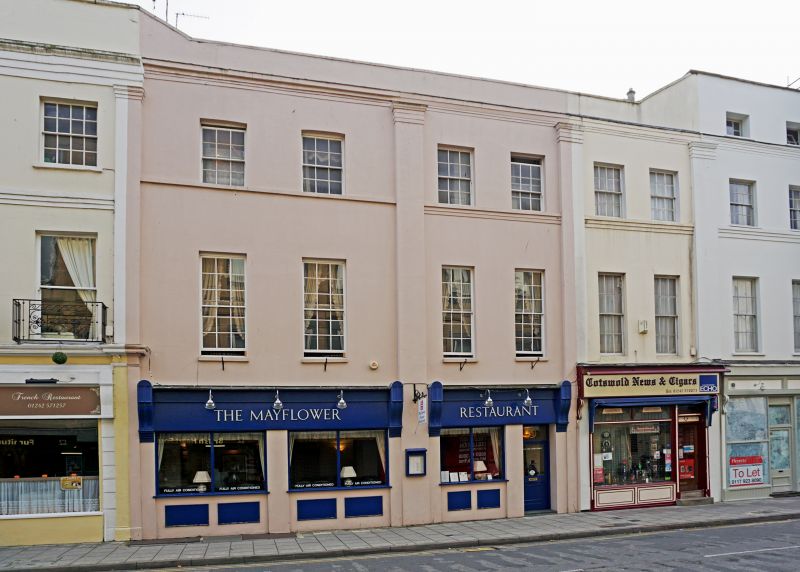
Includes: No.1 CRESCENT PLACE. Terrace of 8 houses, now shops with flats over. c1830-40 with late-C19 ground-floor shop fronts. Stucco over brick with concealed roof and brick and stucco end and party-wall stacks. EXTERIOR: 3 storeys and attic at outer ends, 16 first-floor windows including 1 to each angle, curved on plan, arranged 1:2:3:2:2:2:2:1:1. Stucco detailing includes horizontal rustication to ground floor at left; No.30 has Tuscan pilasters to ground floor at outer ends; second-floor stepped plat band interrupted by Tuscan pilasters through ground, first and second floors (except to Nos 28 and 30), continuous entablature, blocking course to centre range, ramped upwards to attics which have pilasters and entablature to left (No.28), (otherwise missing), frieze and cornice to No.28, otherwise low parapet and copings. First and second floors have mainly 6/6 sashes, taller to first floor where there are some 9/9, some 8/8 sashes to second floor; 4/4 sashes where original to attic storey. Attics have 4/4 sashes, curved on plan to angle, otherside blind and casement windows. Ground floor: shop fronts boarded up at left, but with entrance to left angle a glazed door; otherwise mainly C20 glazed shop fronts, that to No.36 has 1930s leaded glazing to 'frieze'; 2 shop fronts to right are Victorian with pilasters and corbel brackets to frieze and cornice. Entrance to right return a 4-panel, part-glazed door. Cornice over ground floor to right and return. Right return: 3 first-floor windows. Horizontal rustication to ground floor; aprons to ground-floor windows; pilaster to end and first-floor band. 6/6 sashes, some blind windows to attic. Entrance a part-glazed, 4-panel door. INTERIOR: not inspected. HISTORICAL NOTE: not shown on Merrett's Map of 1834. No.36 was a greengrocer's shop in 1892. No.40 was the Great Western Hotel from 1892 to 1957.
Listing NGR: SO9478722458
External links are from the relevant listing authority and, where applicable, Wikidata. Wikidata IDs may be related buildings as well as this specific building. If you want to add or update a link, you will need to do so by editing the Wikidata entry.


Other nearby listed buildings