Latitude: 51.9011 / 51°54'3"N
Longitude: -2.0776 / 2°4'39"W
OS Eastings: 394758
OS Northings: 222504
OS Grid: SO947225
Mapcode National: GBR 2M4.PKJ
Mapcode Global: VH947.YH10
Plus Code: 9C3VWW2C+CX
Entry Name: Bank House (Number 45)
Listing Date: 12 March 1955
Last Amended: 26 November 1998
Grade: II
Source: Historic England
Source ID: 1386863
English Heritage Legacy ID: 474275
ID on this website: 101386863
Location: Cheltenham, Gloucestershire, GL50
County: Gloucestershire
District: Cheltenham
Electoral Ward/Division: Lansdown
Parish: Non Civil Parish
Built-Up Area: Cheltenham
Traditional County: Gloucestershire
Lieutenancy Area (Ceremonial County): Gloucestershire
Church of England Parish: Cheltenham, St Mary with St Matthew
Church of England Diocese: Gloucester
Tagged with: Architectural structure
CHELTENHAM
SO9422NE CLARENCE STREET 630-1/9/277 (North side) 12/03/55 Nos.45-51 (Odd) Bank House (No.45) (Formerly Listed as: CLARENCE STREET (North side) Nos.45-49 (Odd)) (Formerly Listed as: CLARENCE STREET (North side) No.51)
GV II
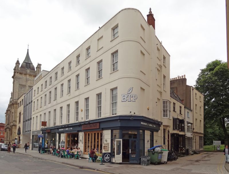
4 houses, now shops with flats and offices over. Numbered right to left, described left to right. c1810-30 with mid-C19 ground-floor shop front to No.49, otherwise C20. Stucco over brick with concealed roofs and brick party-wall stacks. Double depth plan with side stairhalls. EXTERIOR: 4 storeys, 12 first-floor windows (3 per house); No.45 occupies a corner site and is curved to right end. Stucco detailing includes first- and second-floor plat bands, frieze to Nos 49 and 51; copings to low parapet. First and second floors have 6/6 sashes, taller to first floor. Third floor has 3/3 sashes, centre openings to Nos 45 and 49 are blind. All in plain reveals and with sills. No.49 has left entrance with pilastered surround and overlight, one pilaster shared with glazed shop front with windows canted towards shop entrance, glazed double doors, 3 fluted Ionic pilasters with wreaths and columnette mullions. Right return: 3-window range; first-floor bow window, the centre a 6/6 sash between 4/4 sashes, otherwise 6/6, 3/3 and blind windows. INTERIOR: not inspected. HISTORICAL NOTE: shown on Merrett's Map of 1834. No.45 forms a group with Nos 5 and 6 (qv) and 7 (qv) Well Walk. No.51 listed 05.05.72. (Merrett HS: Plan of the Town of Cheltenham: 1834-).
Listing NGR: SO9475922513
External links are from the relevant listing authority and, where applicable, Wikidata. Wikidata IDs may be related buildings as well as this specific building. If you want to add or update a link, you will need to do so by editing the Wikidata entry.


Other nearby listed buildings