Latitude: 52.1082 / 52°6'29"N
Longitude: -2.0732 / 2°4'23"W
OS Eastings: 395080
OS Northings: 245539
OS Grid: SO950455
Mapcode National: GBR 2JM.YF0
Mapcode Global: VHB0R.08TQ
Plus Code: 9C4V4W5G+7P
Entry Name: 39, Bridge Street
Listing Date: 11 February 1965
Grade: II
Source: Historic England
Source ID: 1386952
English Heritage Legacy ID: 474368
ID on this website: 101386952
Location: Pershore, Wychavon, Worcestershire, WR10
County: Worcestershire
District: Wychavon
Civil Parish: Pershore
Built-Up Area: Pershore
Traditional County: Worcestershire
Lieutenancy Area (Ceremonial County): Worcestershire
Church of England Parish: Pershore
Church of England Diocese: Worcester
Tagged with: Building
PERSHORE
SO9545 BRIDGE STREET 648-1/5/35 (East side) 11/02/65 No.39
GV II
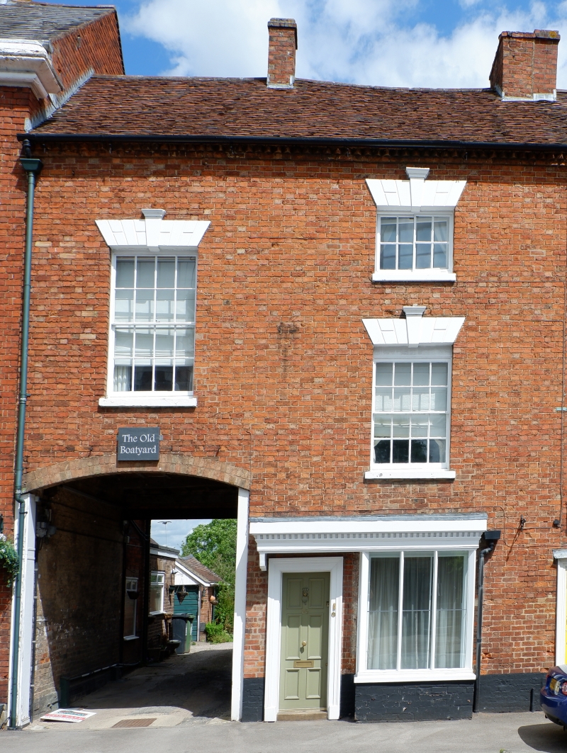
House. Late C18/early C19. Red brick in Flemish bond. Plain tile roof with brick dentilled eaves and brick stacks to centre of ridge and right end. EXTERIOR: 2 and 3 storeys; 2 bays. Right-hand bay of 3 storeys has an 8-pane side-sliding sash on 2nd floor and an 8/8 sash to 1st floor, both with painted channelled voussoirs, keystones and sills; on ground floor a remodelled bay-window with plate glazing, deep corner mullions, and dentilled cornice extending also over 6-panel door in wooden architrave on left. Left-hand bay has large 8/8 sash with narrow glazing bars and arch and sills as before above segmental-arched carriage entrance which has double plank gates with metal spikes and beams and joists exposed within arch. Rear elevation has brick dentilled eaves above carriage entrance. INTERIOR: not inspected.
Listing NGR: SO9508045539
External links are from the relevant listing authority and, where applicable, Wikidata. Wikidata IDs may be related buildings as well as this specific building. If you want to add or update a link, you will need to do so by editing the Wikidata entry.


Other nearby listed buildings