Latitude: 52.1109 / 52°6'39"N
Longitude: -2.0771 / 2°4'37"W
OS Eastings: 394817
OS Northings: 245843
OS Grid: SO948458
Mapcode National: GBR 2JM.PP2
Mapcode Global: VH938.Y69M
Plus Code: 9C4V4W6F+95
Entry Name: Wall on North and West Sides of Vicarage Grounds
Listing Date: 3 August 1972
Last Amended: 30 March 1999
Grade: II
Source: Historic England
Source ID: 1387025
English Heritage Legacy ID: 474441
ID on this website: 101387025
Location: Pershore, Wychavon, Worcestershire, WR10
County: Worcestershire
District: Wychavon
Civil Parish: Pershore
Built-Up Area: Pershore
Traditional County: Worcestershire
Lieutenancy Area (Ceremonial County): Worcestershire
Church of England Parish: Pershore
Church of England Diocese: Worcester
Tagged with: Wall
PERSHORE
SO9445 CHURCH STREET 648-1/5/92 (South side) 03/08/72 Wall on north and west sides of Vicarage grounds (Formerly Listed as: CHURCH STREET (South side) Wall at Vicarage)
GV II
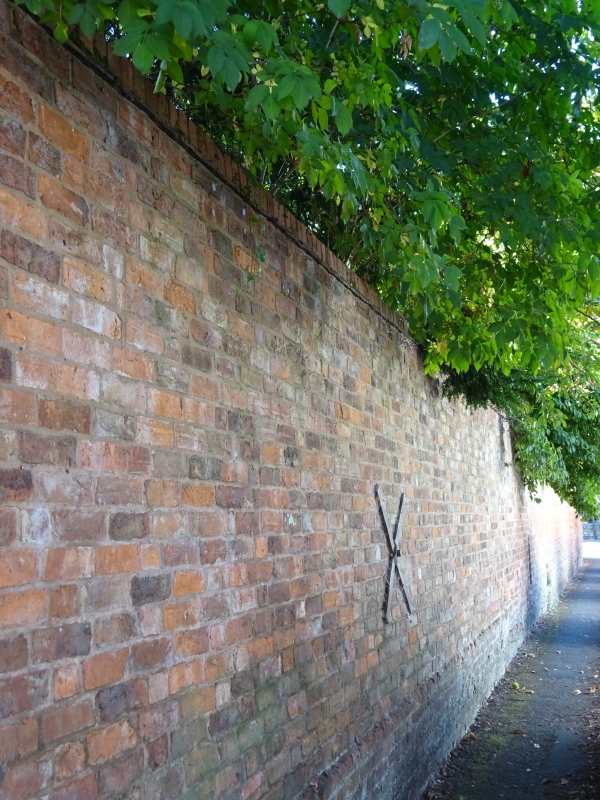
Includes: Wall on north and west sides of Vicarage grounds CHURCH WALK. Vicarage boundary wall fronting Church Street and Church Walk. Mid C18-mid C19. Red brick, with some yellow, partly in Flemish bond and partly in Flemish garden wall bond, with metal tie-bars. Coped partly in tile and brick, and partly in saddle-back-moulded brick above oversailing brick course. Plinth to part. The wall is of different heights, sweeping or ramping up and down. Segmental-arched gateway onto Church Street; rendered gate piers with stone cornices and capstones on Church Walk.
Listing NGR: SO9481345842
External links are from the relevant listing authority and, where applicable, Wikidata. Wikidata IDs may be related buildings as well as this specific building. If you want to add or update a link, you will need to do so by editing the Wikidata entry.


Other nearby listed buildings