Approximate Location Map
Large Map »
Latitude: 52.1102 / 52°6'36"N
Longitude: -2.0773 / 2°4'38"W
OS Eastings: 394801
OS Northings: 245762
OS Grid: SO948457
Mapcode National: GBR 2JM.PM4
Mapcode Global: VH938.Y755
Plus Code: 9C4V4W6F+33
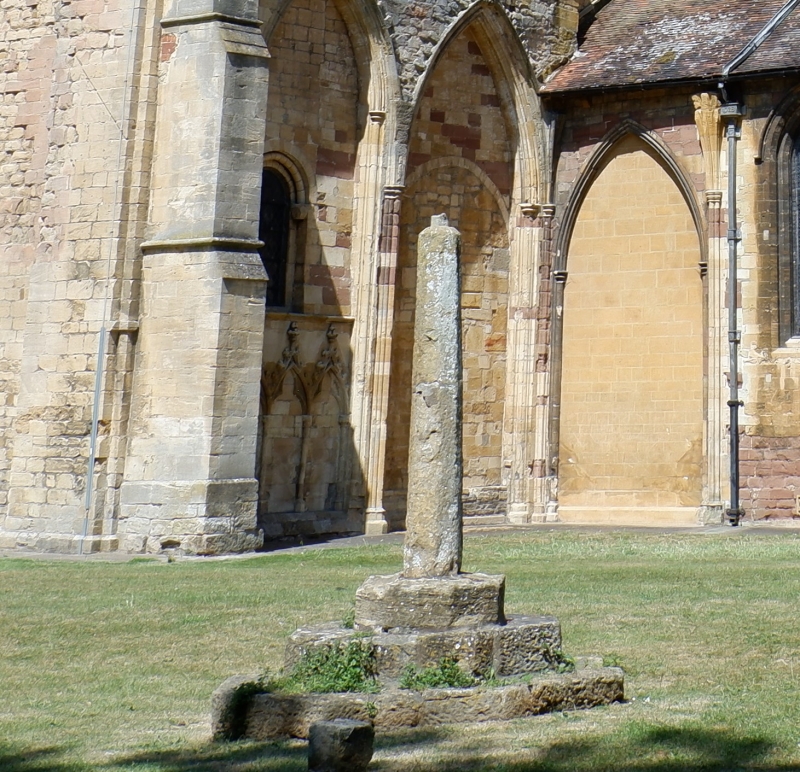
Entry Name: Cross Approximately 20 Metres South of South Chancel Wall of Abbey Church
Listing Date: 11 February 1965
Last Amended: 30 March 1999
Grade: II
Source: Historic England
Source ID: 1387028
English Heritage Legacy ID: 474444
ID on this website: 101387028
Location: Abbey Park, Pershore, Wychavon, Worcestershire, WR10
County: Worcestershire
District: Wychavon
Civil Parish: Pershore
Built-Up Area: Pershore
Traditional County: Worcestershire
Lieutenancy Area (Ceremonial County): Worcestershire
Church of England Parish: Pershore
Church of England Diocese: Worcester
Tagged with: Monumental cross
PERSHORE
SO9445 CHURCH WALK
648-1/5/96 (West side)
11/02/65 Cross approx 20 metres south of
south chancel wall of Abbey Church
(Formerly Listed as:
Cross near Abbey Church)
GV II
Churchyard cross. C15, probably 1st half. Limestone. Octagonal
shaft set in octagonal base on 2 octagonal steps. Cross
missing.
Listing NGR: SO9480145762
External links are from the relevant listing authority and, where applicable, Wikidata. Wikidata IDs may be related buildings as well as this specific building. If you want to add or update a link, you will need to do so by editing the Wikidata entry.


Other nearby listed buildings
