Approximate Location Map
Large Map »
Latitude: 51.5019 / 51°30'6"N
Longitude: -0.1059 / 0°6'21"W
OS Eastings: 531564
OS Northings: 179811
OS Grid: TQ315798
Mapcode National: GBR NH.CS
Mapcode Global: VHGR0.3HWZ
Plus Code: 9C3XGV2V+QJ
Entry Name: Bollard
Listing Date: 12 February 2004
Grade: II
Source: Historic England
Source ID: 1390785
English Heritage Legacy ID: 491614
ID on this website: 101390785
Location: North Southwark, Southwark, London, SE1
County: London
District: Southwark
Electoral Ward/Division: Cathedrals
Parish: Non Civil Parish
Built-Up Area: Southwark
Traditional County: Surrey
Lieutenancy Area (Ceremonial County): Greater London
Church of England Parish: Waterloo St John with St Andrew
Church of England Diocese: Southwark
Tagged with: Bollard
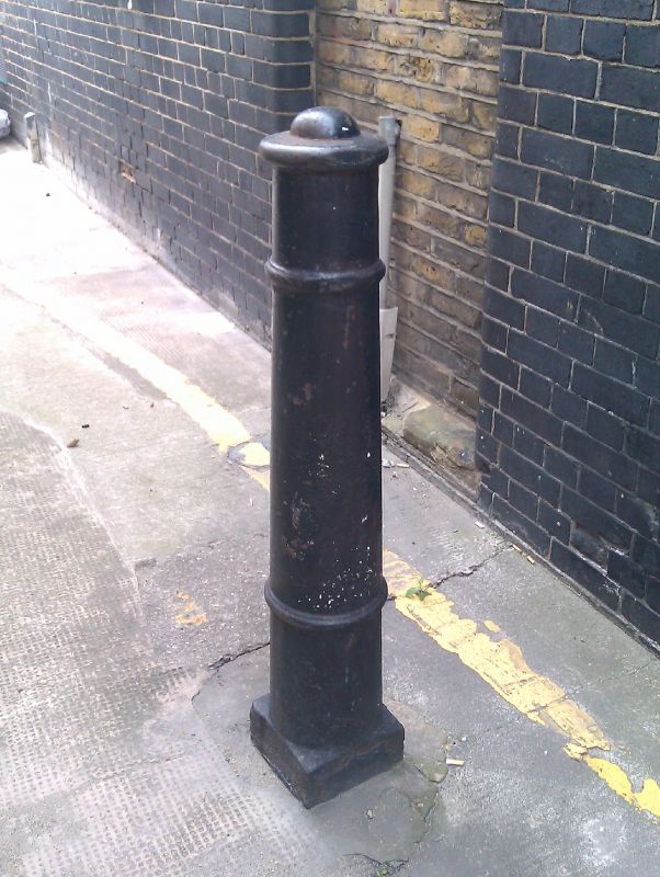
636-1/0/10053 PONTYPOOL PLACE
12-FEB-04 Bollard
II
Bollard. Early to mid C19. Cast iron cannon-shaped bollard about three feet high, tapering to the base with domed cap, three moulded bands, on square plinth.
External links are from the relevant listing authority and, where applicable, Wikidata. Wikidata IDs may be related buildings as well as this specific building. If you want to add or update a link, you will need to do so by editing the Wikidata entry.


Other nearby listed buildings
