Latitude: 53.2314 / 53°13'53"N
Longitude: -0.8977 / 0°53'51"W
OS Eastings: 473678
OS Northings: 371052
OS Grid: SK736710
Mapcode National: GBR BH8.FVH
Mapcode Global: WHFGW.51SK
Plus Code: 9C5X64J2+HW
Entry Name: Tuxford War Memorial
Listing Date: 8 December 2014
Grade: II
Source: Historic England
Source ID: 1421779
ID on this website: 101421779
Location: St Nicholas' Church, Tuxford, Bassetlaw, Nottinghamshire, NG22
County: Nottinghamshire
District: Bassetlaw
Civil Parish: Tuxford
Built-Up Area: Tuxford
Traditional County: Nottinghamshire
Lieutenancy Area (Ceremonial County): Nottinghamshire
Church of England Parish: Tuxford
Church of England Diocese: Southwell and Nottingham
Tagged with: War memorial Memorial
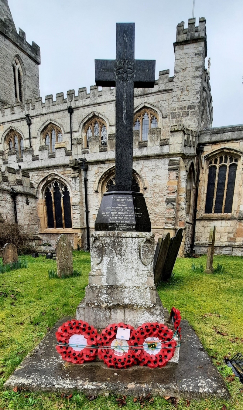
War memorial, unveiled 1921.
War memorial unveiled in 1921, designed and built by H J Tuttell.
A dark polished granite Latin cross (of 1999) rises from a tapering hexagonal plinth of the same material. This carries the inscription, running round three faces, which reads IN THANKSGIVING TO/ ALMIGHTY GOD/ FOR/ VICTORY/ AND IN GRATEFUL MEMORY OF THE/ MEN OF TUXFORD/ WHO GAVE THEIR LIVES FOR THEIR COUNTRY/ AND THE WORLD'S FREEDOM IN THE/ GREAT WAR, 1914 - 1918./ GRANT THEM THY PEACE, LORD./ ERECTED/ BY THE RESIDENTS OF/ TUXFORD . The plinth also carries the 16 names of those who died in the First World War, and of the seven lost in the Second.
The plinth stands on a three-stepped octagonal limestone base surmounted by black polished granite double plinth and cross. Four shields carved in relief on four corners of plinth with PRO DEO/ PRO RECTO/ PRO PATRIA/ PRO REGE.
This List entry has been amended to add sources for War Memorials Online and the War Memorials Register. These sources were not used in the compilation of this List entry but are added here as a guide for further reading, 24 January 2017.
The war memorial, in remembrance of the men of Tuxford lost in the First World War, was unveiled on 27 November 1921 by Mr D Walpole of the British Legion, and dedicated by the Archdeacon of Newark, the Ven Egbert Hacking. It was designed and made by HJ Tuttell (of Lincoln) and cost £163. In 1999, the carved cross of the memorial was replaced as the original was lost through storm damage.
Tuxford war memorial, unveiled in 1921, is listed at Grade II for the following principal reasons:
* Historic interest: as an eloquent witness to the tragic impact of world events on the local community, and the sacrifice it made in the conflicts of the C20;
* Group value: with the Grade I listed church of St Nicholas and other listed structures nearby.
External links are from the relevant listing authority and, where applicable, Wikidata. Wikidata IDs may be related buildings as well as this specific building. If you want to add or update a link, you will need to do so by editing the Wikidata entry.


Other nearby listed buildings