Approximate Location Map
Large Map »
Latitude: 50.5614 / 50°33'40"N
Longitude: -2.4281 / 2°25'41"W
OS Eastings: 369773
OS Northings: 73601
OS Grid: SY697736
Mapcode National: GBR PZ.2QDK
Mapcode Global: FRA 57SL.5W0
Plus Code: 9C2VHH6C+HQ
Entry Name: Battery approximately 80m SE of East Weare Camp
Listing Date: 26 February 2018
Grade: II
Source: Historic England
Source ID: 1444030
ID on this website: 101444030
Location: Portland Port, Dorset, DT5
County: Dorset
Civil Parish: Portland
Traditional County: Dorset
Lieutenancy Area (Ceremonial County): Dorset
Tagged with: Architectural structure Artillery battery
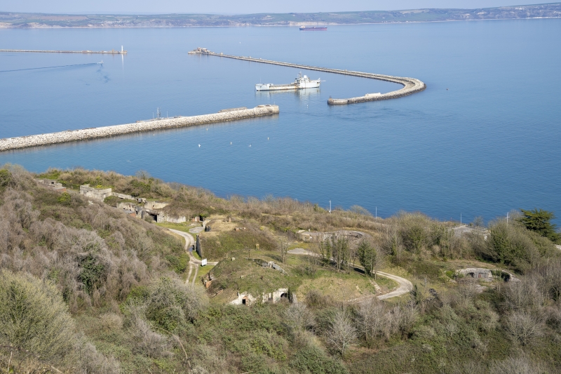
A large battery dating originally from the 1860s, altered during the 1880s and again during the C20. It is located on the NE side of the Isle of Portland.
A large battery dating originally from the 1860s, altered during the 1880s and again during the C20. It is located on the NE side of the Isle of Portland.
MATERIALS: the battery has magazine stores constructed primarily of stone under earth mounds, with gun positions of concrete and stone.
PLAN: the battery is entered from the north along a vehicle track which passes garrison buildings and the former Battery B (not listed); south of these is a freestanding, L-shaped building and the magazine stores which are housed within a large earth mound. This has an internal corridor running roughly north - south with the stores accessed off it. The two gun positions lie to the east.
EXTERIOR: there is a small, L-shaped building of coursed stone at the north-west corner of the magazine stores. This has a ramped parapet wall, individual door and window openings corresponding to the rooms within. This survives relatively intact from the original 1860s construction.
To the south, the large magazine store is housed underneath an earth mound. The western part of the magazine sections of stone elevations with arched openings which give access to the corridor within. The walls are of coursed ashlar stone with some later brick repairs.
To the east there are two gun positions from the rebuilding c.1900, mostly of concrete with some surviving ironwork and curving passages to the sides with sections of collapsed ceiling.
INTERIOR: The northern L-shaped building has four rooms, each with their own external access. Some of these rooms have later fireplaces inserted.
In the main magazine building there is a series of six barrel-vaulted rooms which are accessed from a long internal passage. These rooms were shell stores and cartridge stores, with a shelter for men at the southern end. The walls are mostly of stone, with brick vaulted ceilings, and some rooms retain timber doors, some with painted signs. At the end of each room is a small opening, with a lighting passage beyond. To the east there are believed to be further subterranean stores (not inspected).
The area around Portland Harbour has historically been recognised as an important military strategic location. During the mid-c19, a period of growing political and military concern over French foreign policy led to an arms race between the United Kingdom and France and in 1845 the Royal Navy established a base at Portland, constructing a new harbour where its fleet of steam-driven warships could be replenished with coal. In 1859, due to concerns over a possible French invasion the Prime Minister, Lord Palmerston, instigated the establishment of the Royal Commission of the Defence of the United Kingdom, which recommended that vital points along the south coast, including the Royal Dockyards at Portsmouth, Chatham, Plymouth and Portland, be fortified. As a consequence, the defences at East Weare, to the south of Portland Harbour, were developed and the Verne Citadel fort (1857-81) and East Weare Battery (1862-69) were constructed. East Weare Camp was established c.1880 and from 1889 the rifle range was built. The building of Verne High Angle Battery in 1892 and Upton Fort in 1902 demonstrate the continuing importance of Portland as a strategic location.
Five batteries were completed at East Weare between 1862 and 1869; these were armed with 9in and 10in rifled muzzle loading (RML) guns, and varied in size and plan. They were arranged on the NE slopes of Portland, overlooking the harbour. A series of photographs taken in 1877 show the batteries as originally built, with gun positions located with the magazine stores behind them, concealed by angular earth mounds.
Due to continually advancing technology, the batteries quickly became outdated and had been updated by 1886 to take C pivot 9in RMLs. The two batteries at the southern end of the site, which were at that time known as A Battery (the furthest south) and B Battery, were again updated c.1890; Battery B then having three10in RML guns and Battery A with two 10in RMLs.
A final upgrading took place between 1899 and 1901. A Battery was converted at this time to take two 9.2in breech loading (BL) guns, and three 6in BL guns were installed in B Battery. New magazine stores were constructed and the original magazine became the sergeant's mess and quarters. From this time on it seems that the two were collectively known as A Battery. A series of hand-drawn plans thought to date from the end of the C19 and the early C20 shows the batteries as altered at that time and much as they survive today.
The batteries ceased active military service after 1945, and were for some time used for Royal Navy training exercises, including disaster relief and riot training.
The 1860s battery approximately 80m south-east of East Weare Camp, formerly known at Battery A, is listed at Grade II for the following principal reasons:
Architectural interest:
* As a good example of a battery dating from the 1860s, with some architectural detailing and use of good quality Portland stone;
* For the good degree of survival of historic fabric, and the legibility of its layout.
Historic interest:
* As part of the C19 and earlier defences at East Weare, which played an important role in British naval history.
Group value:
* As part of a complete naval base of considerable importance, specifically designed as the first safe anchorage for the replenishment of the navy's fleet of steam-driven warships;
* Portland Harbour and the nearby coast of the Isle of Portland has a significant collection of designated assets associated with the military history of the area.
External links are from the relevant listing authority and, where applicable, Wikidata. Wikidata IDs may be related buildings as well as this specific building. If you want to add or update a link, you will need to do so by editing the Wikidata entry.


Other nearby listed buildings