Latitude: 51.8654 / 51°51'55"N
Longitude: -0.4242 / 0°25'27"W
OS Eastings: 508596
OS Northings: 219714
OS Grid: TL085197
Mapcode National: GBR G5J.1KL
Mapcode Global: VHFRM.LCLS
Plus Code: 9C3XVH8G+58
Entry Name: Walled Gardens at Stockwood Park
Listing Date: 1 September 2020
Grade: II
Source: Historic England
Source ID: 1468977
ID on this website: 101468977
Location: Stockwood Park, Farleygreen, Luton, Bedfordshire, LU1
County: Luton
Electoral Ward/Division: Farley
Parish: Non Civil Parish
Built-Up Area: Luton
Traditional County: Bedfordshire
Lieutenancy Area (Ceremonial County): Bedfordshire
Tagged with: Walled garden
Walled gardens dating to the mid-C18 and C19.
Walled gardens dating to the mid-C18 and C19.
MATERIALS: the south walled garden is constructed of handmade brick of deep red and plum hues, laid mostly in English bond but with some repaired sections in Flemish bond, surmounted by a mixture of flat and saddleback brick coping. The north walled garden is constructed of red brick laid in Flemish bond, repaired in places, with saddleback brick coping.
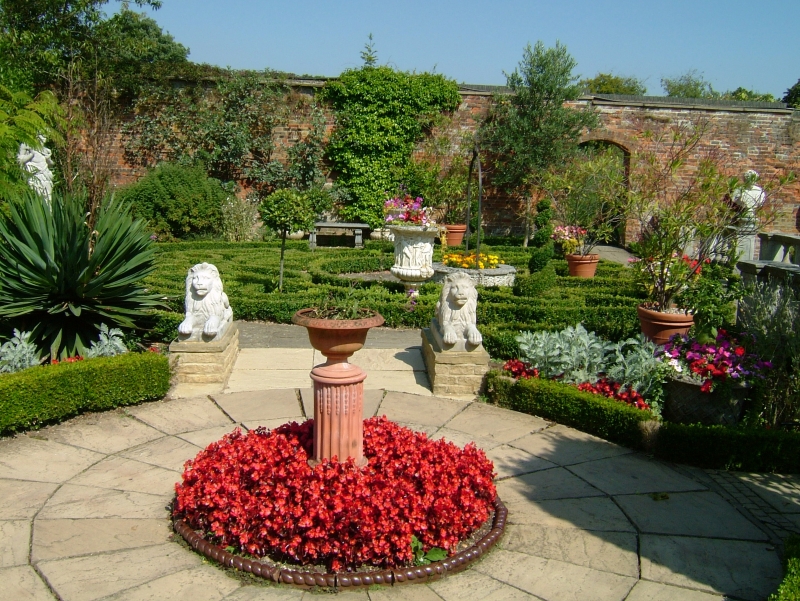
PLAN: the walled gardens are situated to the north-east of the Grade II listed stable block. They consist of two compartments, both of irregular plans. The south garden, of mid-C18 date, is an approximate rectangle although the east corner is curved. Adjoining it on the north side is the larger north garden which has an irregular pentagon plan.
EXTERIOR: there are numerous entrances on all sides of the south garden, most of which are later openings with concrete lintels or brick arches and modern gates. The main entrance is on the curved east corner through an opening (not original) with a concrete lintel and modern gate. The opening at the south-east end of the south-west wall is flanked by brick pilasters which appear to be original. There are several sections of repaired brickwork laid in Flemish bond, probably dating to the C19, notably to the right of the main entrance and on the north-west wall. The repaired sections have flat coping of vitrified brick.
The north garden is multi-phased with the long north wall and shorter north-east wall being constructed of C19 brick. It has been much repaired and patched up in places, especially along the south-east wall. A wide segmental arch opening has been made on the south-west wall, probably around the late C19, to provide access to the service yard containing two ranges of outbuildings, both much altered and therefore not included in the listing. Another wide opening with double-leaf timber doors, of C20 date, is located on the west wall through a pair of tall brick piers surmounted by stone pineapple finials. The long north wall is buttressed on the outer side and a long glasshouse leans against the inner side but as this has been rebuilt in the C20 it is not included in the listing. There is a breach in the north-west wall where the café was built in 2005-2008. The long south-east side is lowered on its south-western half and topped by iron spearhead railings.
Stockwood was acquired by Richard Crawley in 1708 but it was his son, John, who was the main creator of the estate. John Crawley had already enlarged the estate by 1740 when he married a local heiress, Susannah Vanacker Sambrooke, and built a Palladian mansion, along with stables and a walled kitchen garden to the north-east. John continued to expand the estate until his death in 1767, after which progress was maintained by his widow and his son John. The younger John had no direct heir but his younger brother Samuel (d 1805) married a Nottinghamshire heiress, Eliza Rankin. Another Samuel Crawley (d1852), presumably their son, bought further properties; and still later a few purchases were made by his son, John Sambrooke Crawley.
The distinctive irregular pentagon-shaped walled garden is shown on the Crawley Estate Atlas of 1825, the Luton Tithe Map of 1842, and also on Cumberland’s Map of the Borough of Luton of 1876. An article about Stockwood Park in The Cottage Gardener and Country Gentleman (October 11 1859) describes a ‘handsome conservative wall’ to the south-east, partly ‘lowered and topped with iron-palisading’ which turns north-west to join up with ‘the old garden wall’. The walled gardens are therefore multi-phase, originating in the mid-C18 and, based on cartographic evidence, taking their main form by the early C19.
The first edition Ordnance Survey map of 1880 shows the layout of the walled gardens consisting of a smaller south compartment dating to the C18 and the larger north compartment dating to the early C19. The south garden contains three parallel glasshouses (since demolished) in the north-west half and trees – presumably fruit-bearing – in the south-east half. The north garden is divided into four quarters by tree-lined paths with a group of four glasshouses in the south corner. Extensive glasshouses are described in The Cottage Gardener and Country Gentleman article (1859) which presumably includes the two Grade II listed structures. The other two shown on the 1880 map, positioned at right angles, have narrow building ranges to the rear. These ranges, along with the two glasshouses, have been rebuilt in the C20, and two further glasshouses have been erected in the south corner. The 1880 map shows that a long glasshouse adjoined the south side of the north garden wall. This has also been rebuilt in the C20. Two other building ranges are shown adjoining the outer side of the west wall. These contained potting sheds, tool sheds, boiler house etc which have since been extensively altered.
By the early C20 the expansion of Luton had almost surrounded Stockwood Park with suburban housing. The Crawley family left in 1939 when the house was converted into the Alexandra Hospital for children with hip disorders and in 1945 the park was purchased by Luton Borough Council. The walled gardens were used as the borough’s flower nursery. The house was demolished in 1964 but the stable block was retained and then converted into a craft museum as part of the restoration works undertaken in the mid-1980s. The walled garden was planted as a series of period gardens, and in 1985 Ian Hamilton Finlay (1925-2006) was commissioned to design a contrasting ‘modern’ sculpture garden to the south, known as the Improvement Garden (registered Grade II*). In 2005-2008 the Stockwood Discovery Centre was built to the designs of Buttress, Fuller, Also, Williams. This included a café which was built across the easternmost side of the walled garden, creating a breach in the wall.
The walled gardens dating to the mid-C18 and C19 are listed at Grade II for the following principal reasons:
Architectural interest
* the curved corner of the C18 walled garden and the irregular pentagon of the C19 one are both fairly unusual adaptations of the typical rectangular or square plan which was the most common plan during this period and throughout the C19;
* they have undergone considerable repair in some areas but are on such a large scale that a significant proportion of the historic brickwork still survives, forming an extensive and notable area of horticultural production.
Historic interest
* they are an important and integral element at Stockwood Park, pre-dating the proliferation of walled gardens built at many country house estates in the early Victorian period.
Group value
* they have strong group value with the stable block and glasshouses, both listed at Grade II, and the Grade II* registered Improvement Garden, altogether forming an important ensemble illustrating the evolution of the Stockwood estate over almost three centuries.
External links are from the relevant listing authority and, where applicable, Wikidata. Wikidata IDs may be related buildings as well as this specific building. If you want to add or update a link, you will need to do so by editing the Wikidata entry.


Other nearby listed buildings