Latitude: 55.9318 / 55°55'54"N
Longitude: -2.3626 / 2°21'45"W
OS Eastings: 377445
OS Northings: 671028
OS Grid: NT774710
Mapcode National: GBR NFJ1.8C5
Mapcode Global: WH8WG.P55G
Plus Code: 9C7VWJJP+PX
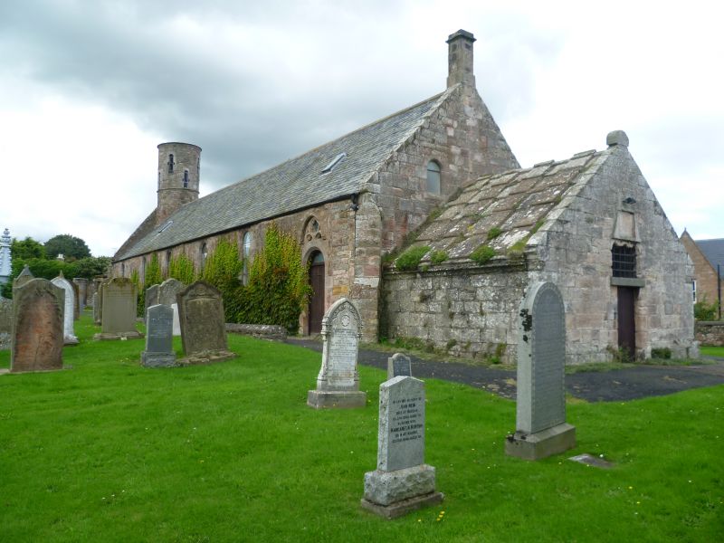
Entry Name: Churchyard, Cockburnspath Parish Church
Listing Name: Cockburnspath Church and Graveyard
Listing Date: 9 June 1971
Category: A
Source: Historic Scotland
Source ID: 335358
Historic Scotland Designation Reference: LB4129
Building Class: Cultural
Also known as: Cockburnspath Parish Church, Churchyard
ID on this website: 200335358
Location: Cockburnspath
County: Scottish Borders
Electoral Ward: East Berwickshire
Parish: Cockburnspath
Traditional County: Berwickshire
Tagged with: Churchyard
Unique in having a round tower in centre of west wall; long narrow building with angle buttresses, not later than 16th century; small tomb house with pointed barrel vault abutts east wall.
External links are from the relevant listing authority and, where applicable, Wikidata. Wikidata IDs may be related buildings as well as this specific building. If you want to add or update a link, you will need to do so by editing the Wikidata entry.


Other nearby listed buildings