Approximate Location Map
Large Map »
Latitude: 55.9203 / 55°55'13"N
Longitude: -3.434 / 3°26'2"W
OS Eastings: 310481
OS Northings: 670622
OS Grid: NT104706
Mapcode National: GBR KFW2.3PS
Mapcode Global: WH6SP.7G18
Plus Code: 9C7RWHC8+4C
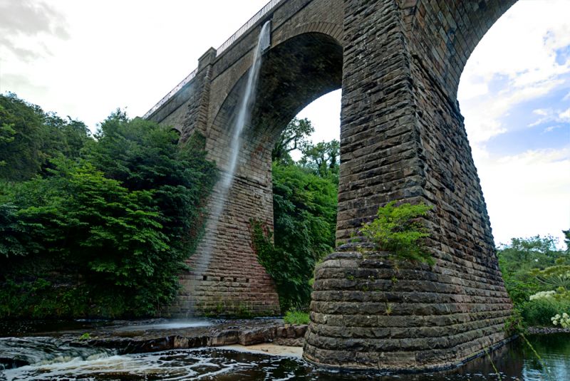
Entry Name: Almond Aqueduct, Union Canal
Listing Name: Union Canal, Almond Aqueduct, River Avon Near Linn's Mill.
Listing Date: 22 February 1971
Category: A
Source: Historic Scotland
Source ID: 339303
Historic Scotland Designation Reference: LB7430
Building Class: Cultural
ID on this website: 200339303
Location: Kirkliston
County: West Lothian
Electoral Ward: East Livingston and East Calder
Parish: Kirkliston
Traditional County: Midlothian
c.1820. Hugh Baird, Engineer. 5 semi-circular arches.
Coursers; dressed voussoirs, rock-faced piers. Iron
railings at parapet.
Half in Kirkliston Parish, Midlothian.
External links are from the relevant listing authority and, where applicable, Wikidata. Wikidata IDs may be related buildings as well as this specific building. If you want to add or update a link, you will need to do so by editing the Wikidata entry.


Other nearby listed buildings
