Approximate Location Map
Large Map »
Latitude: 57.3437 / 57°20'37"N
Longitude: -2.199 / 2°11'56"W
OS Eastings: 388121
OS Northings: 828152
OS Grid: NJ881281
Mapcode National: GBR N9X9.Z55
Mapcode Global: WH9PQ.6P32
Plus Code: 9C9V8RV2+FC
Entry Name: Limekiln, Pitmedden House Policies
Listing Name: Pitmedden Lime-Kiln
Listing Date: 16 April 1971
Category: B
Source: Historic Scotland
Source ID: 349627
Historic Scotland Designation Reference: LB15926
Building Class: Cultural
Also known as: Pitmedden House Policies, Limekiln
ID on this website: 200349627
Location: Udny
County: Aberdeenshire
Electoral Ward: Mid Formartine
Parish: Udny
Traditional County: Aberdeenshire
Tagged with: Lime kiln
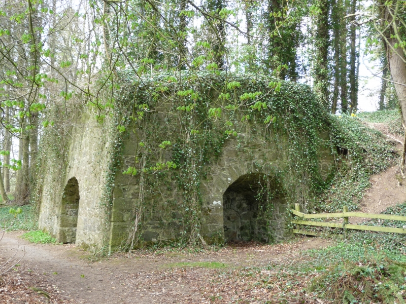
Late 18th/early 19th century. Square plan about 28',
battered pinned rubble walls, 3 segmentally arched drawholes.
External links are from the relevant listing authority and, where applicable, Wikidata. Wikidata IDs may be related buildings as well as this specific building. If you want to add or update a link, you will need to do so by editing the Wikidata entry.


Other nearby listed buildings
