Approximate Location Map
Large Map »
Latitude: 55.891 / 55°53'27"N
Longitude: -3.0765 / 3°4'35"W
OS Eastings: 332771
OS Northings: 666951
OS Grid: NT327669
Mapcode National: GBR 60YB.R2
Mapcode Global: WH6T1.Q667
Plus Code: 9C7RVWRF+9C
Entry Name: Railway Overbridge, Cemetery Road, Dalkeith
Listing Name: Cemetery Road, Bridge
Listing Date: 9 March 1992
Category: B
Source: Historic Scotland
Source ID: 360248
Historic Scotland Designation Reference: LB24336
Building Class: Cultural
Also known as: Dalkeith, Cemetery Road, Railway Overbridge
ID on this website: 200360248
Location: Dalkeith
County: Midlothian
Town: Dalkeith
Electoral Ward: Dalkeith
Traditional County: Midlothian
Tagged with: Railway bridge
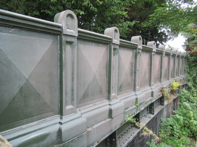
Mid 19th century. Narrow bridge, on N-S axis. Saddleback coped stugged ashlar piers; wrought-iron plate girder. Massive cast-iron parapets; 11-bay, with inverted nailhead panels divided by panelled pilasters and raised semicircular blocks.
This bridge was built after 1853. This bridge crosses the dismantled North British Railway.
External links are from the relevant listing authority and, where applicable, Wikidata. Wikidata IDs may be related buildings as well as this specific building. If you want to add or update a link, you will need to do so by editing the Wikidata entry.


Other nearby listed buildings
