Latitude: 55.8949 / 55°53'41"N
Longitude: -3.069 / 3°4'8"W
OS Eastings: 333247
OS Northings: 667385
OS Grid: NT332673
Mapcode National: GBR 7008.CN
Mapcode Global: WH6T1.T3S6
Plus Code: 9C7RVWVJ+XC
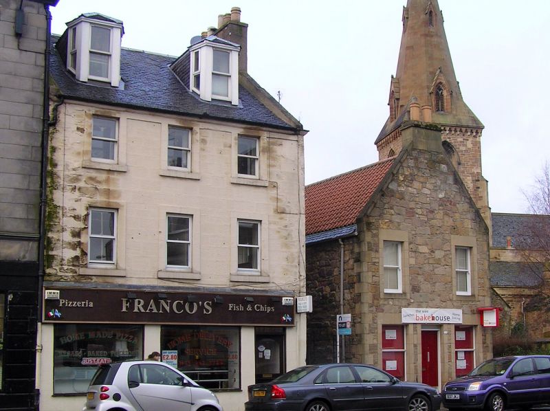
Entry Name: 113 High Street, Dalkeith
Listing Name: 113 High Street, and 1A, 1B Brunton's Close
Listing Date: 17 November 1987
Category: B
Source: Historic Scotland
Source ID: 360317
Historic Scotland Designation Reference: LB24396
Building Class: Cultural
Also known as: Dalkeith, 113 High Street
ID on this website: 200360317
Location: Dalkeith
County: Midlothian
Electoral Ward: Dalkeith
Traditional County: Midlothian
Tagged with: Architectural structure
External links are from the relevant listing authority and, where applicable, Wikidata. Wikidata IDs may be related buildings as well as this specific building. If you want to add or update a link, you will need to do so by editing the Wikidata entry.


Other nearby listed buildings