Approximate Location Map
Large Map »
Latitude: 56.4566 / 56°27'23"N
Longitude: -2.9788 / 2°58'43"W
OS Eastings: 339773
OS Northings: 729813
OS Grid: NO397298
Mapcode National: GBR Z8Z.DL
Mapcode Global: WH7RB.6ZS5
Plus Code: 9C8VF24C+JF
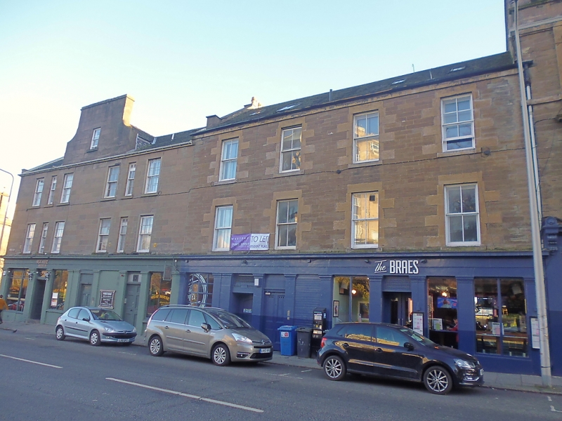
Entry Name: 10, 12, 14, 16, 18, 20 Perth Road, Dundee
Listing Name: 10-16 (Even Nos) Perth Road
Listing Date: 6 January 1981
Category: C
Source: Historic Scotland
Source ID: 361920
Historic Scotland Designation Reference: LB25583
Building Class: Cultural
ID on this website: 200361920
Location: Dundee
County: Dundee
Town: Dundee
Electoral Ward: West End
Traditional County: Angus
Tagged with: Architectural structure
Circa 1850. 3-storey and basement, 4-storey rear due to
slope of land, 4-bay, coursed rubble. Ashlar. Pilastered
and corniced shopfronts. Eaves course.
4-storey rear, basement doors, central wallhead stacks, 2
dormers. Ridge stack shared with Nos 2-8.
Slate roof. Windows sash and case, 4-pane glazing pattern.
External links are from the relevant listing authority and, where applicable, Wikidata. Wikidata IDs may be related buildings as well as this specific building. If you want to add or update a link, you will need to do so by editing the Wikidata entry.


Other nearby listed buildings
