Approximate Location Map
Large Map »
Latitude: 55.0688 / 55°4'7"N
Longitude: -3.615 / 3°36'54"W
OS Eastings: 296964
OS Northings: 576122
OS Grid: NX969761
Mapcode National: GBR 396T.4R
Mapcode Global: WH5WJ.FVSJ
Plus Code: 9C7R399M+GX
Entry Name: 20, 22 Brewery Street, Dumfries
Listing Name: 20, 22 Brewery Street
Listing Date: 6 March 1981
Category: C
Source: Historic Scotland
Source ID: 362582
Historic Scotland Designation Reference: LB26095
Building Class: Cultural
ID on this website: 200362582
Location: Dumfries
County: Dumfries and Galloway
Town: Dumfries
Electoral Ward: Nith
Traditional County: Dumfriesshire
Tagged with: Retail store
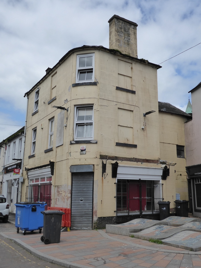
Early 19th century. 3 storeys, with shallow recessed and
curved corner bay. Painted droved ashlar and projecting
cills. 2 bays to Brewery Street, single bay to Friars'
Vennel. Shop at ground with door in curved corner; sash
windows above ground, some blind, 1 with original 12-pane
glazing pattern. End stacks; slate roof, curved and
piended at S.
Shop signs at 1st floor.
External links are from the relevant listing authority and, where applicable, Wikidata. Wikidata IDs may be related buildings as well as this specific building. If you want to add or update a link, you will need to do so by editing the Wikidata entry.


Other nearby listed buildings
