Approximate Location Map
Large Map »
Latitude: 55.0688 / 55°4'7"N
Longitude: -3.6146 / 3°36'52"W
OS Eastings: 296991
OS Northings: 576121
OS Grid: NX969761
Mapcode National: GBR 396T.7R
Mapcode Global: WH5WJ.FVZJ
Plus Code: 9C7R399P+G5
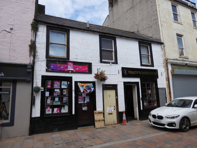
Entry Name: 13, 15 Friars Vennel, Dumfries
Listing Name: 11, 13, 15 Friars Vennel
Listing Date: 6 March 1981
Category: C
Source: Historic Scotland
Source ID: 362716
Historic Scotland Designation Reference: LB26190
Building Class: Cultural
ID on this website: 200362716
Location: Dumfries
County: Dumfries and Galloway
Town: Dumfries
Electoral Ward: Nith
Traditional County: Dumfriesshire
Tagged with: Architectural structure
Circa 1800. 2 storeys, 3 bays. Painted stugged and
coursed rubble and margins. 3 inner doors (pend central);
enlarged shop windows in outer bays. Plate glass
sashes at 1st door. End stacks; slate roofs.
External links are from the relevant listing authority and, where applicable, Wikidata. Wikidata IDs may be related buildings as well as this specific building. If you want to add or update a link, you will need to do so by editing the Wikidata entry.


Other nearby listed buildings
