Approximate Location Map
Large Map »
Latitude: 55.9195 / 55°55'10"N
Longitude: -3.2008 / 3°12'2"W
OS Eastings: 325051
OS Northings: 670247
OS Grid: NT250702
Mapcode National: GBR 8MT.4J
Mapcode Global: WH6SS.TG0X
Plus Code: 9C7RWQ9X+QM
Entry Name: Icehouse, Hermitage Of Braid, Braid Road, Edinburgh
Listing Name: Hermitage of Braid, off Braid Road, Ice House
Listing Date: 30 March 1993
Category: C
Source: Historic Scotland
Source ID: 364586
Historic Scotland Designation Reference: LB27420
Building Class: Cultural
ID on this website: 200364586
Location: Edinburgh
County: Edinburgh
Town: Edinburgh
Electoral Ward: Morningside
Traditional County: Midlothian
Tagged with: Icehouse
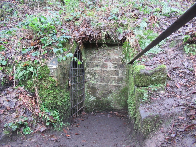
18th century. Subterranean rubble-built ice house to S of Hermitage of Braid, immediately above the Braid Burn and connected to it by drainage channel. Small pointed-arch doorway with stugged dressings and barred pointed-arch gate to entrance passage. Circular well with brick-arched ceiling.
Group with Hermitage of Braid and dovecot.
External links are from the relevant listing authority and, where applicable, Wikidata. Wikidata IDs may be related buildings as well as this specific building. If you want to add or update a link, you will need to do so by editing the Wikidata entry.


Other nearby listed buildings
