Approximate Location Map
Large Map »
Latitude: 55.9209 / 55°55'15"N
Longitude: -3.3111 / 3°18'40"W
OS Eastings: 318159
OS Northings: 670535
OS Grid: NT181705
Mapcode National: GBR 24.ZS3R
Mapcode Global: WH6SR.3FJT
Plus Code: 9C7RWMCQ+9H
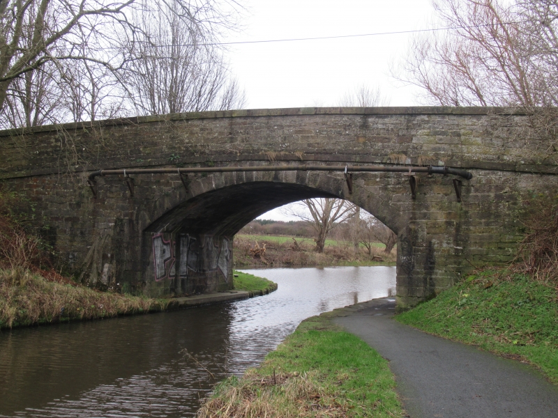
Entry Name: East Hermiston Bridge, Union Canal
Listing Name: Union Canal, East Hermiston Bridge, Bridge No 10
Listing Date: 31 January 1981
Category: B
Source: Historic Scotland
Source ID: 365130
Historic Scotland Designation Reference: LB27798
Building Class: Cultural
Also known as: Union Canal, East Hermiston Bridge
ID on this website: 200365130
Location: Edinburgh
County: Edinburgh
Town: Edinburgh
Electoral Ward: Pentland Hills
Traditional County: Midlothian
Tagged with: Bridge
Hugh Baird, engineer. Circa 1820. Single span bridge. Coursed and squared rubble; stugged sandstone segmental arch; advanced keystone with '10' inscribed. Parapet with string course and ashlar coping.
The Edinburgh and Glasgow Union Canal was built 1818-1822 and was designed by Hugh Baird.
Scheduled Monument.
External links are from the relevant listing authority and, where applicable, Wikidata. Wikidata IDs may be related buildings as well as this specific building. If you want to add or update a link, you will need to do so by editing the Wikidata entry.


Other nearby listed buildings
