Approximate Location Map
Large Map »
Latitude: 55.9214 / 55°55'17"N
Longitude: -3.3084 / 3°18'30"W
OS Eastings: 318330
OS Northings: 670588
OS Grid: NT183705
Mapcode National: GBR 24.ZSTJ
Mapcode Global: WH6SR.4FTF
Plus Code: 9C7RWMCR+HJ
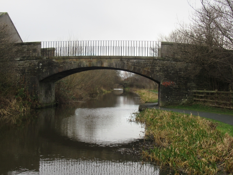
Entry Name: East Hermiston Bridge, Union Canal
Listing Name: Union Canal Bridge 9 East Hermiston
Listing Date: 29 April 1977
Category: C
Source: Historic Scotland
Source ID: 337603
Historic Scotland Designation Reference: LB6096
Building Class: Cultural
ID on this website: 200337603
Location: Currie
County: Edinburgh
Electoral Ward: Pentland Hills
Parish: Currie
Traditional County: Midlothian
Tagged with: Footbridge
c. 1820. Hugh Baird, engineer. Segmental arch. Coursers.
Number on keystones. Iron parapet railings.
External links are from the relevant listing authority and, where applicable, Wikidata. Wikidata IDs may be related buildings as well as this specific building. If you want to add or update a link, you will need to do so by editing the Wikidata entry.


Other nearby listed buildings
