Approximate Location Map
Large Map »
Latitude: 56.1906 / 56°11'26"N
Longitude: -2.8226 / 2°49'21"W
OS Eastings: 349047
OS Northings: 700080
OS Grid: NO490000
Mapcode National: GBR 2Q.FV4X
Mapcode Global: WH7SR.MN3K
Plus Code: 9C8V55RG+6X
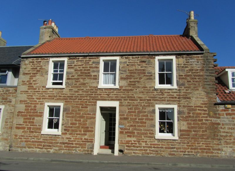
Entry Name: 11 Bank Street, Elie
Listing Name: Elie 11 Bank Street
Listing Date: 18 August 1972
Category: C
Source: Historic Scotland
Source ID: 372097
Historic Scotland Designation Reference: LB30926
Building Class: Cultural
ID on this website: 200372097
Location: Elie and Earlsferry
County: Fife
Town: Elie And Earlsferry
Electoral Ward: East Neuk and Landward
Traditional County: Fife
Tagged with: Architectural structure
Early 19th century. 2-storey 3-window coursed rubble with painted margins and dressings, pantiled with slate skirting.
B Group.
External links are from the relevant listing authority and, where applicable, Wikidata. Wikidata IDs may be related buildings as well as this specific building. If you want to add or update a link, you will need to do so by editing the Wikidata entry.


Other nearby listed buildings
