Approximate Location Map
Large Map »
Latitude: 56.1904 / 56°11'25"N
Longitude: -2.8223 / 2°49'20"W
OS Eastings: 349062
OS Northings: 700059
OS Grid: NO490000
Mapcode National: GBR 2Q.FV68
Mapcode Global: WH7SR.MN7Q
Plus Code: 9C8V55RH+53
Entry Name: 12 Bank Street, Elie
Listing Name: Elie 12 Bank Street
Listing Date: 8 January 1980
Category: C
Source: Historic Scotland
Source ID: 372103
Historic Scotland Designation Reference: LB30932
Building Class: Cultural
ID on this website: 200372103
Location: Elie and Earlsferry
County: Fife
Town: Elie And Earlsferry
Electoral Ward: East Neuk and Landward
Traditional County: Fife
Tagged with: Architectural structure
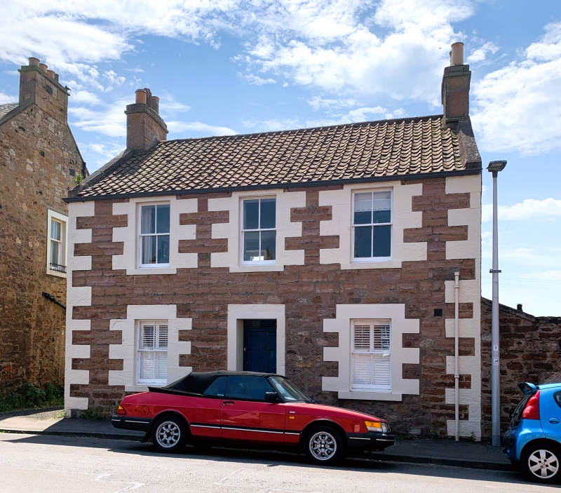
18th century, altered, 2-storey coursed rubble with large droved ashlar dressings, 3 window front, central panelled door later shop to right with blocked door and window. Pantiled roof, skews to front, crowsteps to rear, ashlar end stacks. Large 2 storey rendered addition at back.
4 pane sashes. Low wall linking with 14, door in later 19th century
surround and small boarded opening with large lintel.
External links are from the relevant listing authority and, where applicable, Wikidata. Wikidata IDs may be related buildings as well as this specific building. If you want to add or update a link, you will need to do so by editing the Wikidata entry.


Other nearby listed buildings
