Approximate Location Map
Large Map »
Latitude: 56.1905 / 56°11'25"N
Longitude: -2.8228 / 2°49'22"W
OS Eastings: 349033
OS Northings: 700063
OS Grid: NO490000
Mapcode National: GBR 2Q.FV2C
Mapcode Global: WH7SR.MN0P
Plus Code: 9C8V55RG+5V
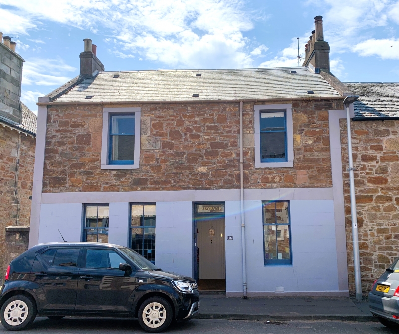
Entry Name: 16 Bank Street, Elie
Listing Name: Elie 16 Bank Street
Listing Date: 8 January 1980
Category: C
Source: Historic Scotland
Source ID: 372105
Historic Scotland Designation Reference: LB30934
Building Class: Cultural
ID on this website: 200372105
Location: Elie and Earlsferry
County: Fife
Town: Elie And Earlsferry
Electoral Ward: East Neuk and Landward
Traditional County: Fife
Tagged with: Architectural structure
Late 18th/early 19th century altered. 2-storey, rubble with large droved ashlar dressings, raised and painted margins at first floor. Ground floor altered and painted with shop left, central door and window to right. Moulded string first floor level. Slated roof, skews and stacks rendered left and brick right. Catslide and flat roofed rear extensions.
External links are from the relevant listing authority and, where applicable, Wikidata. Wikidata IDs may be related buildings as well as this specific building. If you want to add or update a link, you will need to do so by editing the Wikidata entry.


Other nearby listed buildings
