Approximate Location Map
Large Map »
Latitude: 56.1907 / 56°11'26"N
Longitude: -2.819 / 2°49'8"W
OS Eastings: 349270
OS Northings: 700086
OS Grid: NO492000
Mapcode National: GBR 2Q.FW29
Mapcode Global: WH7SR.NNTJ
Plus Code: 9C8V55RJ+7C
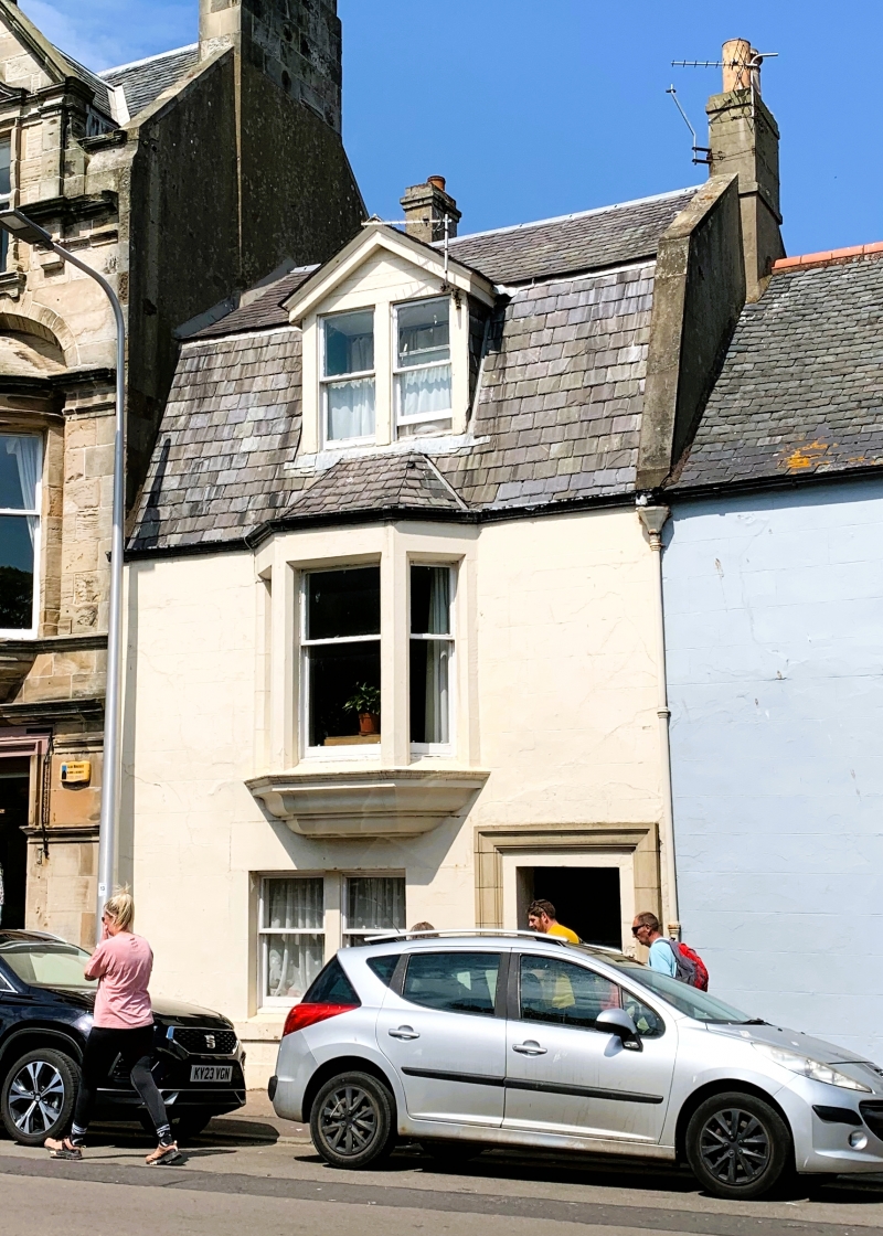
Entry Name: 39 High Street, Elie
Listing Name: Elie 39 High Street
Listing Date: 8 January 1980
Category: C
Source: Historic Scotland
Source ID: 372126
Historic Scotland Designation Reference: LB30952
Building Class: Cultural
ID on this website: 200372126
Location: Elie and Earlsferry
County: Fife
Town: Elie And Earlsferry
Electoral Ward: East Neuk and Landward
Traditional County: Fife
Tagged with: Architectural structure
Later 19th century rebuilt. 2 storey and attic, rendered and lined as ashlar. Door in modern moulded architrave right, bipartite at ground floor central first floor, corbelled three light canted oriel bay. Bipartite gablet dormer in slated mansard roof with skew and.
External links are from the relevant listing authority and, where applicable, Wikidata. Wikidata IDs may be related buildings as well as this specific building. If you want to add or update a link, you will need to do so by editing the Wikidata entry.


Other nearby listed buildings
