Approximate Location Map
Large Map »
Latitude: 56.1906 / 56°11'26"N
Longitude: -2.8195 / 2°49'10"W
OS Eastings: 349237
OS Northings: 700079
OS Grid: NO492000
Mapcode National: GBR 2Q.FVYD
Mapcode Global: WH7SR.NNKK
Plus Code: 9C8V55RJ+65
Entry Name: 51-51A High Street, Elie
Listing Name: Elie 51, 51A High Street
Listing Date: 8 January 1980
Category: C
Source: Historic Scotland
Source ID: 372128
Historic Scotland Designation Reference: LB30954
Building Class: Cultural
ID on this website: 200372128
Location: Elie and Earlsferry
County: Fife
Town: Elie And Earlsferry
Electoral Ward: East Neuk and Landward
Traditional County: Fife
Tagged with: Retail store
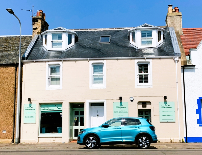
Early 19th century altered. Later 19th century 2-storey and attic, rendered and lined as ashlar with pointed stop-chamfered margins. 3-window front. Central door with shop left (51A), bracketted ogee rhone, 2 canted dormers with metal roofs. Reglazed sashes. Main roof slated with skews and stacks mutual with 49 and 53.
External links are from the relevant listing authority and, where applicable, Wikidata. Wikidata IDs may be related buildings as well as this specific building. If you want to add or update a link, you will need to do so by editing the Wikidata entry.


Other nearby listed buildings
