Approximate Location Map
Large Map »
Latitude: 56.1909 / 56°11'27"N
Longitude: -2.8208 / 2°49'14"W
OS Eastings: 349156
OS Northings: 700110
OS Grid: NO491001
Mapcode National: GBR 2Q.FVLZ
Mapcode Global: WH7SR.MNYC
Plus Code: 9C8V55RH+9M
Entry Name: Parish Church, High Street, Elie
Listing Name: Elie Parish Church High Street
Listing Date: 18 August 1972
Category: B
Source: Historic Scotland
Source ID: 372132
Historic Scotland Designation Reference: LB30958
Building Class: Cultural
Also known as: Elie, High Street, Parish Church
ID on this website: 200372132
Location: Elie and Earlsferry
County: Fife
Town: Elie And Earlsferry
Electoral Ward: East Neuk and Landward
Traditional County: Fife
Tagged with: Church building
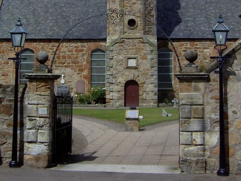
Rebuilt 1831 incorporating central clock tower dated 1726. T-plan, plain rubble with 4-centred arched openings: tower square plan, broached to octagonal and capped by later domed cylindrical belfry: quoined, in-an-out voussoirs to arched doorpiece. Modern west porch and other alterations, reglazed.
Ecclesiastical building in use as such.
External links are from the relevant listing authority and, where applicable, Wikidata. Wikidata IDs may be related buildings as well as this specific building. If you want to add or update a link, you will need to do so by editing the Wikidata entry.


Other nearby listed buildings
