Approximate Location Map
Large Map »
Latitude: 55.8286 / 55°49'42"N
Longitude: -4.2172 / 4°13'2"W
OS Eastings: 261210
OS Northings: 661708
OS Grid: NS612617
Mapcode National: GBR 0VZ.5B
Mapcode Global: WH4QF.6R1L
Plus Code: 9C7QRQHM+C4
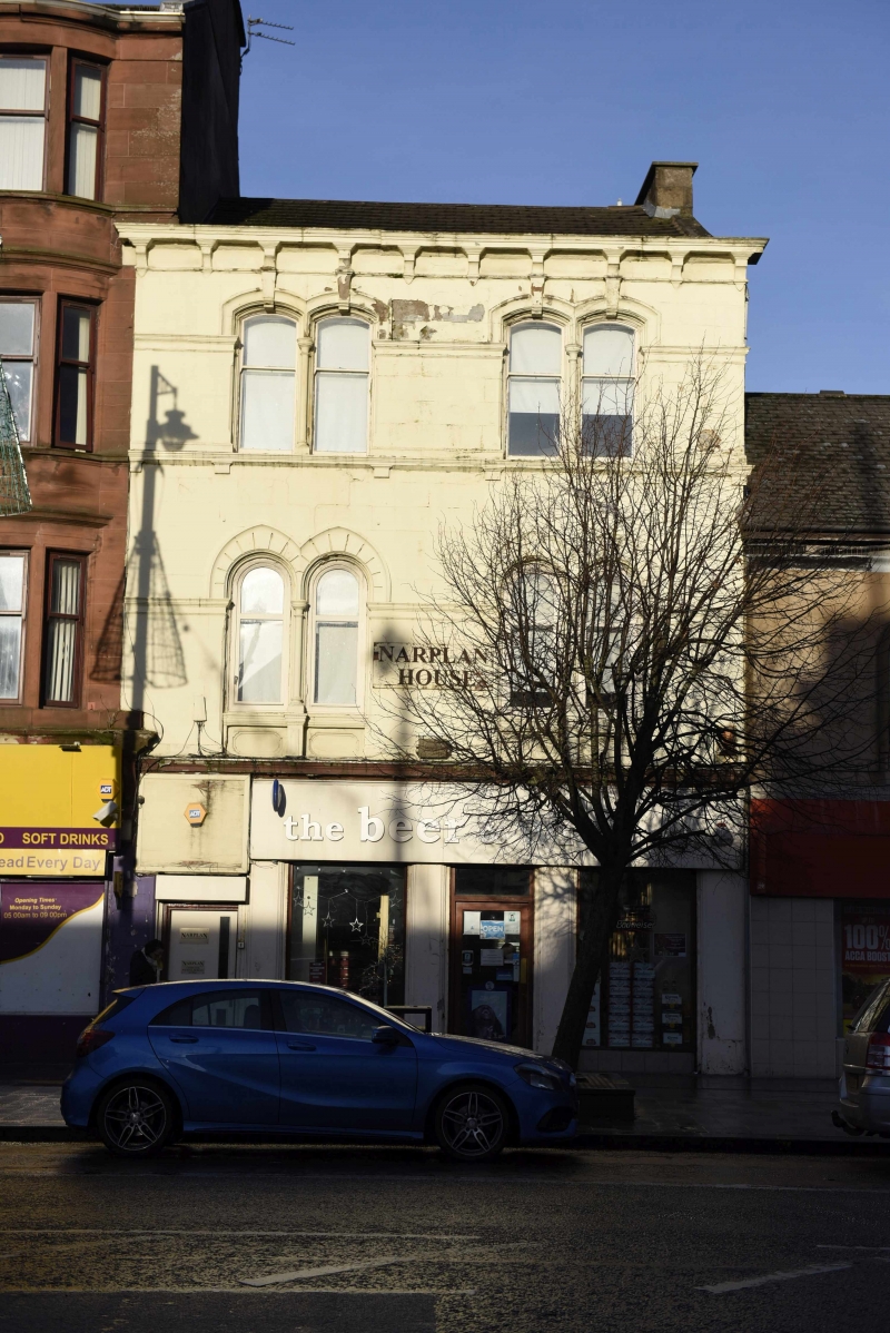
Entry Name: Narplan House, 63, 65 Main Street, Rutherglen, Glasgow
Listing Name: 63, 65 Main Street, Rutherglen, Narplan House
Listing Date: 17 February 1992
Category: C
Source: Historic Scotland
Source ID: 377309
Historic Scotland Designation Reference: LB33559
Building Class: Cultural
ID on this website: 200377309
Location: Rutherglen
County: South Lanarkshire
Town: Rutherglen
Electoral Ward: Rutherglen Central and North
Traditional County: Lanarkshire
Tagged with: Architectural structure
Mid/later 19th century. 3 storeys, 3-bay shop at ground with close door left, 2 bays above with paired windows with columned mullions, round-arched at 1st floor with big arched heads, stilted segmental arches at 2nd; bracketted cornice; cut-down end stack; re-roofed with tiles. Painted ashlar.
Compare detailing with Langside College.
External links are from the relevant listing authority and, where applicable, Wikidata. Wikidata IDs may be related buildings as well as this specific building. If you want to add or update a link, you will need to do so by editing the Wikidata entry.


Other nearby listed buildings
