Latitude: 55.9548 / 55°57'17"N
Longitude: -2.7733 / 2°46'24"W
OS Eastings: 351809
OS Northings: 673801
OS Grid: NT518738
Mapcode National: GBR 2S.XT0D
Mapcode Global: WH7TY.CLLB
Plus Code: 9C7VX63G+WM
Entry Name: 1 The Sands, Haddington
Listing Name: 1 the Sands
Listing Date: 5 December 1977
Category: B
Source: Historic Scotland
Source ID: 378602
Historic Scotland Designation Reference: LB34362
Building Class: Cultural
Also known as: Haddington, 1 The Sands
ID on this website: 200378602
Location: Haddington
County: East Lothian
Town: Haddington
Electoral Ward: Haddington and Lammermuir
Traditional County: East Lothian
Tagged with: House
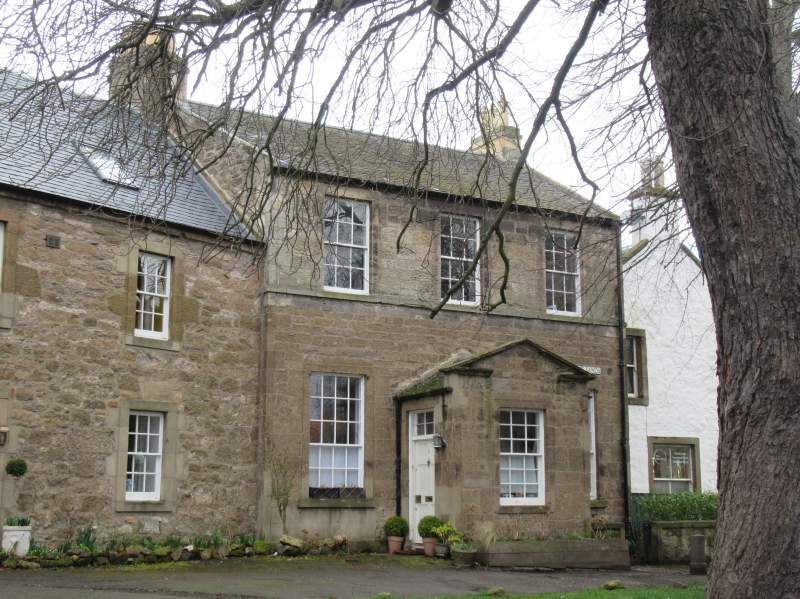
18th century, 2-storey house: ashlar with slated roof:
pedimented porch, entered on flank 3-window at 1st floor.
Original floor levels have been raised to take account of
flooding.
External links are from the relevant listing authority and, where applicable, Wikidata. Wikidata IDs may be related buildings as well as this specific building. If you want to add or update a link, you will need to do so by editing the Wikidata entry.


Other nearby listed buildings