Approximate Location Map
Large Map »
Latitude: 55.9545 / 55°57'16"N
Longitude: -2.7731 / 2°46'23"W
OS Eastings: 351824
OS Northings: 673767
OS Grid: NT518737
Mapcode National: GBR 2S.XT32
Mapcode Global: WH7TY.CLQK
Plus Code: 9C7VX63G+RQ
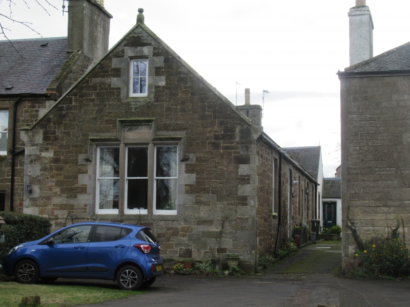
Entry Name: 5 The Sands, Haddington
Listing Name: 5 the Sands
Listing Date: 5 December 1977
Category: C
Source: Historic Scotland
Source ID: 378605
Historic Scotland Designation Reference: LB34365
Building Class: Cultural
ID on this website: 200378605
Location: Haddington
County: East Lothian
Town: Haddington
Electoral Ward: Haddington and Lammermuir
Traditional County: East Lothian
Tagged with: Architectural structure
Reconstructed mid 19th century, Jacobethan detail:
single-storey and attic without dormers, rubble with slated
roof: gable end with ball finial to The Sands: tripartite
window with hood mould, stepped over central panel.
Originally a School Building
External links are from the relevant listing authority and, where applicable, Wikidata. Wikidata IDs may be related buildings as well as this specific building. If you want to add or update a link, you will need to do so by editing the Wikidata entry.


Other nearby listed buildings
