Approximate Location Map
Large Map »
Latitude: 55.9546 / 55°57'16"N
Longitude: -2.7732 / 2°46'23"W
OS Eastings: 351817
OS Northings: 673774
OS Grid: NT518737
Mapcode National: GBR 2S.XT1R
Mapcode Global: WH7TY.CLNJ
Plus Code: 9C7VX63G+RP
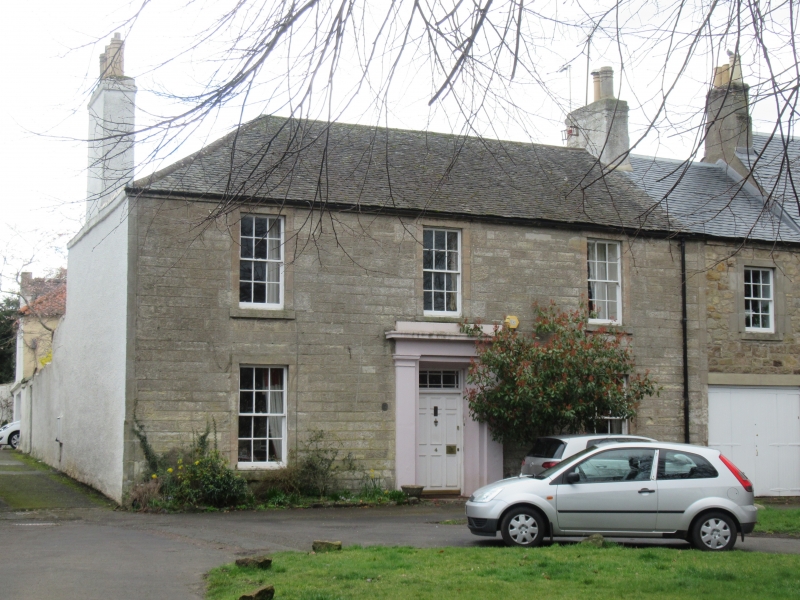
Entry Name: 3-4 The Sands, Haddington
Listing Name: 3, 4 the Sands
Listing Date: 5 December 1977
Category: B
Source: Historic Scotland
Source ID: 378604
Historic Scotland Designation Reference: LB34364
Building Class: Cultural
Also known as: Haddington, 3-4 The Sands
ID on this website: 200378604
Location: Haddington
County: East Lothian
Town: Haddington
Electoral Ward: Haddington and Lammermuir
Traditional County: East Lothian
Tagged with: Architectural structure
Circa 1840: 2-storey house: regular course rubble with slated
roof: pilastered doorpiece with blocking course, 4-window at
1st floor.
External links are from the relevant listing authority and, where applicable, Wikidata. Wikidata IDs may be related buildings as well as this specific building. If you want to add or update a link, you will need to do so by editing the Wikidata entry.


Other nearby listed buildings
