Approximate Location Map
Large Map »
Latitude: 55.5984 / 55°35'54"N
Longitude: -2.7207 / 2°43'14"W
OS Eastings: 354685
OS Northings: 634102
OS Grid: NT546341
Mapcode National: GBR 93FP.SY
Mapcode Global: WH7WQ.5KP1
Plus Code: 9C7VH7XH+9P
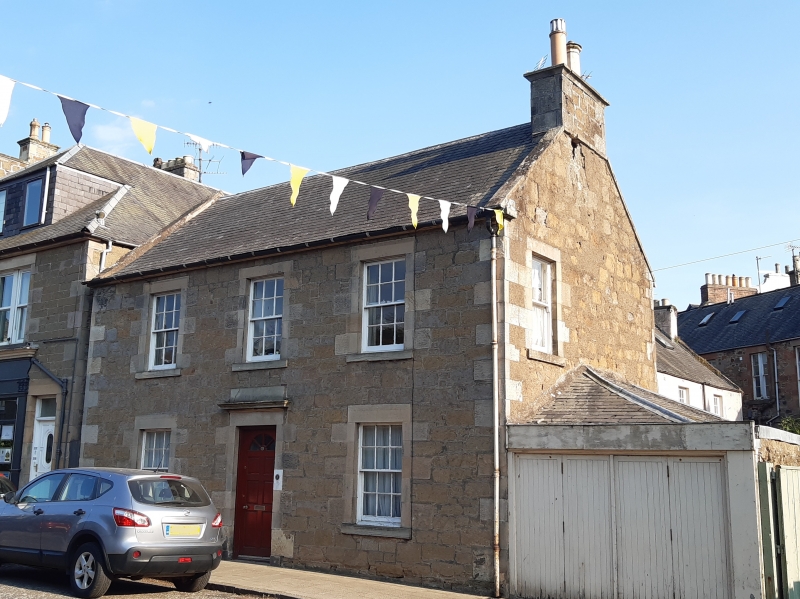
Entry Name: Runcie, Buccleuch Street, Melrose
Listing Name: Buccleuch Street Runcie
Listing Date: 19 February 1981
Category: C
Source: Historic Scotland
Source ID: 382893
Historic Scotland Designation Reference: LB37741
Building Class: Cultural
ID on this website: 200382893
Location: Melrose
County: Scottish Borders
Town: Melrose
Electoral Ward: Leaderdale and Melrose
Traditional County: Roxburghshire
Tagged with: House
Earlier 19th century, 2 storey, 3 bay, coursed squared rubble with droved dressings, centre door with cornice and blocking course over; windows retain original 12 pane double sash glazing straight skews with rectangular coped end-stacks, slated roof.
B Group. Buccleuch Street is not shown on Wood's Map of 1826.
External links are from the relevant listing authority and, where applicable, Wikidata. Wikidata IDs may be related buildings as well as this specific building. If you want to add or update a link, you will need to do so by editing the Wikidata entry.


Other nearby listed buildings
