Approximate Location Map
Large Map »
Latitude: 55.827 / 55°49'37"N
Longitude: -3.2194 / 3°13'9"W
OS Eastings: 323708
OS Northings: 659984
OS Grid: NT237599
Mapcode National: GBR 51Y2.T0
Mapcode Global: WH6T5.JS5S
Plus Code: 9C7RRQGJ+R6
Entry Name: St Kentigern's Church, Kirkyard and Boundary Wall
Listing Date: 22 January 1971
Category: B
Source: Historic Scotland
Source ID: 384915
Historic Scotland Designation Reference: LB39291
Building Class: Cultural
ID on this website: 200384915
Location: Penicuik
County: Midlothian
Town: Penicuik
Electoral Ward: Penicuik
Traditional County: Midlothian
Tagged with: Church building Churchyard
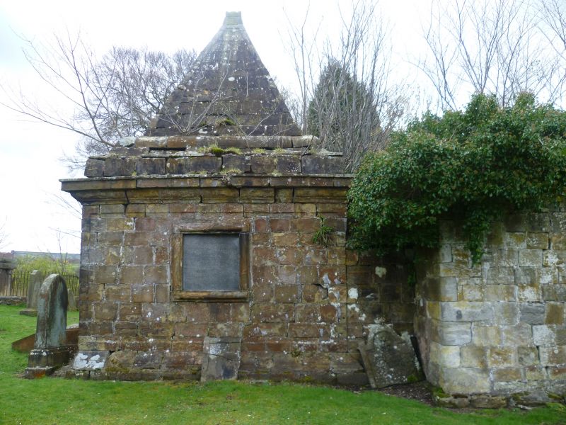
Rubble boundary wall with semicircular coping.
'Penicuik,St Kentigern's Church & Clerk Mausoleum' is Scheduled Monument No 2145 and is excluded from the listing.
Listed building record and statutory address updated in 2015. Previously listed as 'St Kentigern's Church, Kirkyard and Boundary Wall.'
External links are from the relevant listing authority and, where applicable, Wikidata. Wikidata IDs may be related buildings as well as this specific building. If you want to add or update a link, you will need to do so by editing the Wikidata entry.


Other nearby listed buildings
