Approximate Location Map
Large Map »
Latitude: 56.339 / 56°20'20"N
Longitude: -2.7862 / 2°47'10"W
OS Eastings: 351491
OS Northings: 716571
OS Grid: NO514165
Mapcode National: GBR 2R.4PYN
Mapcode Global: WH7S0.5XHT
Plus Code: 9C8V86Q7+JG
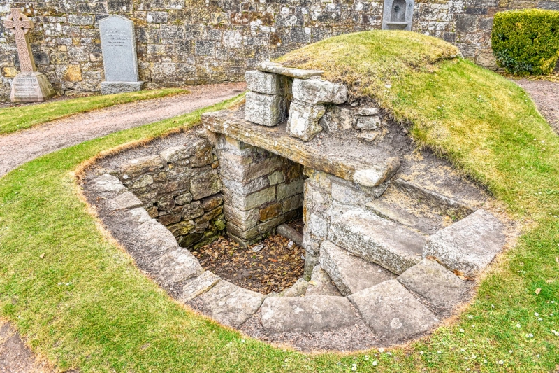
Entry Name: Well-House, Eastern Cemetery
Listing Date: 23 February 1971
Category: B
Source: Historic Scotland
Source ID: 386539
Historic Scotland Designation Reference: LB40591
Building Class: Cultural
ID on this website: 200386539
Location: St Andrews
County: Fife
Town: St Andrews
Electoral Ward: St Andrews
Traditional County: Fife
Tagged with: Well
Small slab-roofed well-house of early date with steps down.
External links are from the relevant listing authority and, where applicable, Wikidata. Wikidata IDs may be related buildings as well as this specific building. If you want to add or update a link, you will need to do so by editing the Wikidata entry.


Other nearby listed buildings
