Latitude: 56.3397 / 56°20'22"N
Longitude: -2.7865 / 2°47'11"W
OS Eastings: 351475
OS Northings: 716648
OS Grid: NO514166
Mapcode National: GBR 2R.4HYD
Mapcode Global: WH7S0.5XC9
Plus Code: 9C8V86Q7+V9
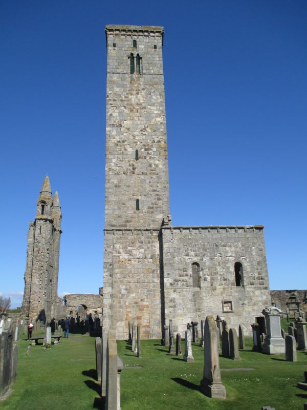
Entry Name: St Rule's Church
Listing Date: 23 February 1971
Category: A
Source: Historic Scotland
Source ID: 386536
Historic Scotland Designation Reference: LB40588
Building Class: Cultural
Also known as: St Rule's Tower
ID on this website: 200386536
Location: St Andrews
County: Fife
Town: St Andrews
Electoral Ward: St Andrews
Traditional County: Fife
Tagged with: Church building Architectural structure
Probably c 1070 enlarged c 1130-40. Tower and roofless choir, nave and sanctuary demolished. Ashlar-built; tower 108'4" high, 14-1/2' square. Originally had spire without parapet, then altered 16th century with parapet and new spire, now destroyed; choir, 26' x 19-3/4' aisleless with tall arch to demolished sanctuary.
Guardianship Monument.
External links are from the relevant listing authority and, where applicable, Wikidata. Wikidata IDs may be related buildings as well as this specific building. If you want to add or update a link, you will need to do so by editing the Wikidata entry.


Other nearby listed buildings