Latitude: 56.3398 / 56°20'23"N
Longitude: -2.7868 / 2°47'12"W
OS Eastings: 351459
OS Northings: 716661
OS Grid: NO514166
Mapcode National: GBR 2R.4HW5
Mapcode Global: WH7S0.5X76
Plus Code: 9C8V86Q7+W7
Entry Name: Cathedral Graveyard
Listing Date: 23 February 1971
Category: A
Source: Historic Scotland
Source ID: 386535
Historic Scotland Designation Reference: LB40587
Building Class: Cultural
ID on this website: 200386535
Location: St Andrews
County: Fife
Town: St Andrews
Electoral Ward: St Andrews
Traditional County: Fife
Tagged with: Cemetery
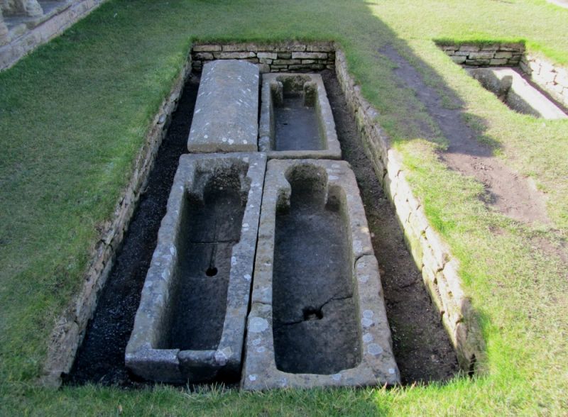
Notable wall monuments 16th cent. onwards; tabletombs and other detached stones of interest; war memorial set in W wall, now lacking cross, Sir R S Lorimer.
Most notable free standing stones now within Cathedral Museum.
External links are from the relevant listing authority and, where applicable, Wikidata. Wikidata IDs may be related buildings as well as this specific building. If you want to add or update a link, you will need to do so by editing the Wikidata entry.


Other nearby listed buildings