Latitude: 56.3393 / 56°20'21"N
Longitude: -2.7935 / 2°47'36"W
OS Eastings: 351043
OS Northings: 716612
OS Grid: NO510166
Mapcode National: GBR 2R.4GCZ
Mapcode Global: WH7S0.2X1K
Plus Code: 9C8V86Q4+PJ
Entry Name: 62 South Street, St Andrews
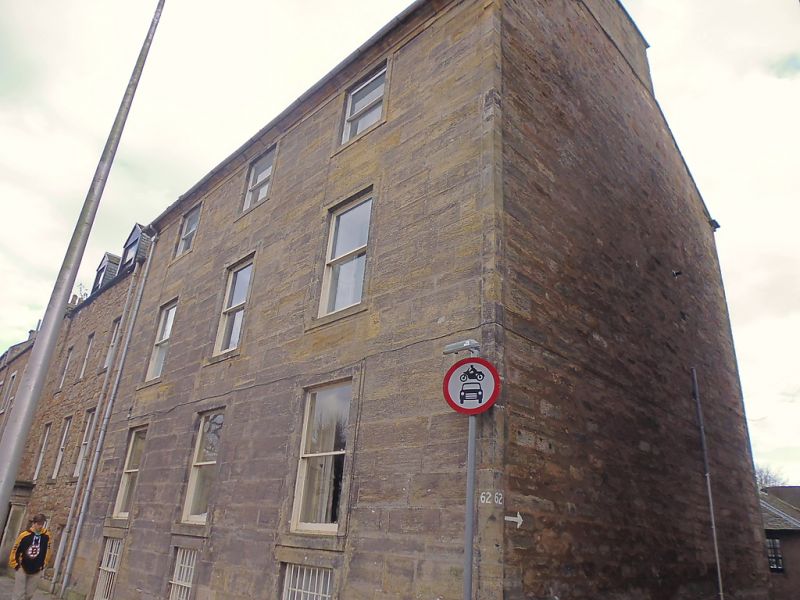
Listing Name: 62 South Street.
Listing Date: 28 April 1959
Category: B
Source: Historic Scotland
Source ID: 386646
Historic Scotland Designation Reference: LB40685
Building Class: Cultural
Also known as: St Andrews, 62 South Street
ID on this website: 200386646
Location: St Andrews
County: Fife
Town: St Andrews
Electoral Ward: St Andrews
Traditional County: Fife
Tagged with: Architectural structure
Late 18th cent. 3-storey and full basement, 3-window; ashlar
with margins, slated; pedimented back. Lang rig shortened at
S end.
External links are from the relevant listing authority and, where applicable, Wikidata. Wikidata IDs may be related buildings as well as this specific building. If you want to add or update a link, you will need to do so by editing the Wikidata entry.


Other nearby listed buildings