Approximate Location Map
Large Map »
Latitude: 56.1286 / 56°7'43"N
Longitude: -3.9368 / 3°56'12"W
OS Eastings: 279712
OS Northings: 694568
OS Grid: NS797945
Mapcode National: GBR 1C.KX4D
Mapcode Global: WH4P6.H7K1
Plus Code: 9C8R43H7+F7
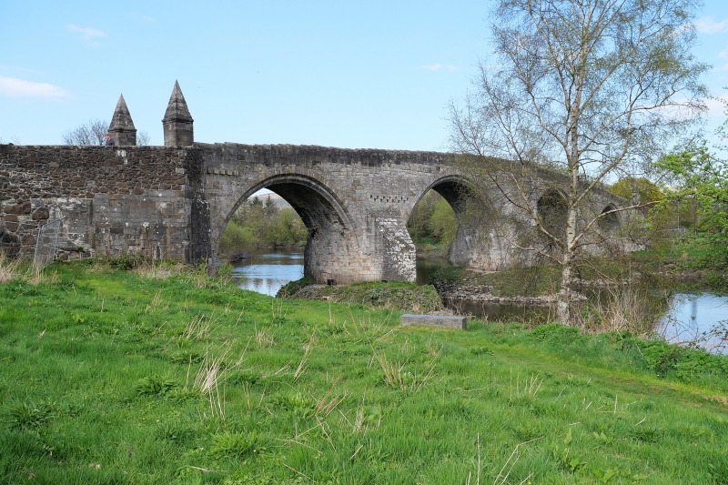
Entry Name: Stirling, Old Bridge
Listing Date: 4 November 1965
Category: A
Source: Historic Scotland
Source ID: 387225
Historic Scotland Designation Reference: LB41129
Building Class: Cultural
Also known as: Stirling Old Bridge
Old Bridge,
ID on this website: 200387225
Location: Stirling
County: Stirling
Town: Stirling
Electoral Ward: Stirling North
Traditional County: Stirlingshire
Tagged with: Road bridge Footbridge
Late 15th/early 16th century.
4 semi-circular arches, 268' long, squared rubble brought to
courses on massive oval rubble-built foundations. Heavy
triangular cut-waters, refuges (originally roofed) at centre.
Square pyramid capped flanking pillars, 18th century. SW arch
cut by General Blakenay in 1745 and rebuilt.
Farther north is site of wooden bridge around which Wallace fought Battle of Stirling.
External links are from the relevant listing authority and, where applicable, Wikidata. Wikidata IDs may be related buildings as well as this specific building. If you want to add or update a link, you will need to do so by editing the Wikidata entry.


Other nearby listed buildings
