Approximate Location Map
Large Map »
Latitude: 56.1277 / 56°7'39"N
Longitude: -3.9362 / 3°56'10"W
OS Eastings: 279742
OS Northings: 694466
OS Grid: NS797944
Mapcode National: GBR 1C.KX8L
Mapcode Global: WH4P6.H7TR
Plus Code: 9C8R43H7+3G
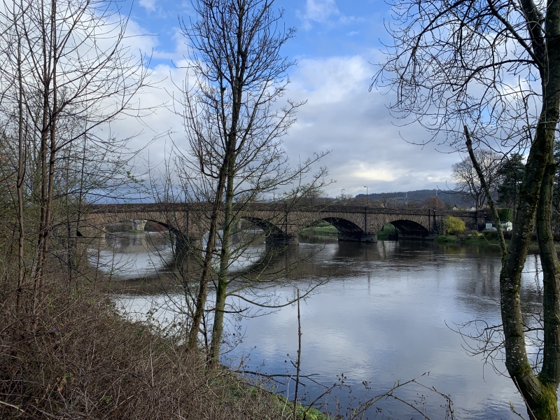
Entry Name: New Bridge, Causewayhead Road, Stirling
Listing Name: Stirling New Bridge
Listing Date: 4 November 1965
Category: B
Source: Historic Scotland
Source ID: 387226
Historic Scotland Designation Reference: LB41130
Building Class: Cultural
Also known as: New Bridge, Stirling
Stirling, Causewayhead Road, New Bridge
ID on this website: 200387226
Location: Stirling
County: Stirling
Town: Stirling
Electoral Ward: Stirling North
Traditional County: Stirlingshire
Tagged with: Bridge Road bridge
Robert Stevenson, engineer Kenneth Mathieson, contractor,
1831-2. 5 segmental arches, bull-faced ashlar.
External links are from the relevant listing authority and, where applicable, Wikidata. Wikidata IDs may be related buildings as well as this specific building. If you want to add or update a link, you will need to do so by editing the Wikidata entry.


Other nearby listed buildings
