Approximate Location Map
Large Map »
Latitude: 56.1242 / 56°7'27"N
Longitude: -3.9483 / 3°56'53"W
OS Eastings: 278984
OS Northings: 694096
OS Grid: NS789940
Mapcode National: GBR 1C.L0ZF
Mapcode Global: WH4P6.BB3G
Plus Code: 9C8R43F2+MM
Entry Name: Stirling Castle Chapel Royal (1594)
Listing Date: 4 November 1965
Category: A
Source: Historic Scotland
Source ID: 387235
Historic Scotland Designation Reference: LB41140
Building Class: Cultural
ID on this website: 200387235
Location: Stirling
County: Stirling
Town: Stirling
Electoral Ward: Stirling North
Traditional County: Stirlingshire
Tagged with: Castle chapel
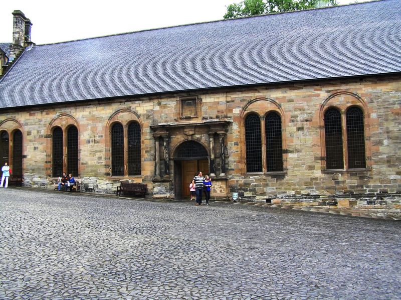
Erected 1594. Decorated in tempera by Valentine Jenkin in
1628-9. Rectangular plan 112' 6" x 37' 3". Rubble-built with
ashlar south front. Central doorway flanked by coupled
columns; 3-2 light windows to either side. Open timber roof
with recent supporting girders.
Formerly used as a military hospital. Restored as regimental banqueting hall. Scheduled Ancient Monument, No 90291.
External links are from the relevant listing authority and, where applicable, Wikidata. Wikidata IDs may be related buildings as well as this specific building. If you want to add or update a link, you will need to do so by editing the Wikidata entry.


Other nearby listed buildings
