Approximate Location Map
Large Map »
Latitude: 58.4416 / 58°26'29"N
Longitude: -3.0939 / 3°5'38"W
OS Eastings: 336234
OS Northings: 950882
OS Grid: ND362508
Mapcode National: GBR L6QF.3D4
Mapcode Global: WH6DN.F2XY
Plus Code: 9CCRCWR4+JC
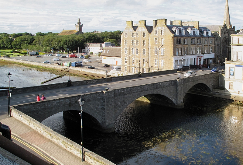
Entry Name: Wick Bridge
Listing Name: Bridge Street, Bridge over Wick River
Listing Date: 13 April 1971
Category: B
Source: Historic Scotland
Source ID: 388810
Historic Scotland Designation Reference: LB42297
Building Class: Cultural
ID on this website: 200388810
Location: Wick
County: Highland
Town: Wick
Electoral Ward: Wick and East Caithness
Tagged with: Road bridge
1875/77. Murdoch Paterson, engineer. Large 3 arched bridge of dressed stone; wide shallow arches borne on rounded cut-waters; string course; wide carriage-way with coped parapets.
ReplacedTelford bridge (1805-7) of similar style.
External links are from the relevant listing authority and, where applicable, Wikidata. Wikidata IDs may be related buildings as well as this specific building. If you want to add or update a link, you will need to do so by editing the Wikidata entry.


Other nearby listed buildings
