Approximate Location Map
Large Map »
Latitude: 55.827 / 55°49'37"N
Longitude: -3.0116 / 3°0'41"W
OS Eastings: 336723
OS Northings: 659766
OS Grid: NT367597
Mapcode National: GBR 71D2.S1
Mapcode Global: WH7VD.QS3V
Plus Code: 9C7RRXGQ+Q9
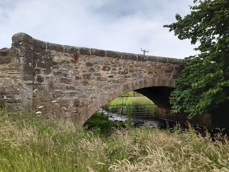
Entry Name: Bridge Over Gore Water, Borthwick
Listing Name: Borthwick, Bridge over Gore Water
Listing Date: 19 March 1998
Category: C
Source: Historic Scotland
Source ID: 391963
Historic Scotland Designation Reference: LB45148
Building Class: Cultural
ID on this website: 200391963
Location: Borthwick
County: Midlothian
Electoral Ward: Midlothian South
Parish: Borthwick
Traditional County: Midlothian
Tagged with: Architectural structure Road bridge
Early 19th century. Semi circular arched bridge. Tooled random rubble; stugged ashlar arch ring. Stugged semi circular coping. Curved wing walls.
External links are from the relevant listing authority and, where applicable, Wikidata. Wikidata IDs may be related buildings as well as this specific building. If you want to add or update a link, you will need to do so by editing the Wikidata entry.


Other nearby listed buildings
