Latitude: 55.7263 / 55°43'34"N
Longitude: -2.3588 / 2°21'31"W
OS Eastings: 377564
OS Northings: 648158
OS Grid: NT775481
Mapcode National: GBR C2Z7.43
Mapcode Global: WH8XF.QBZH
Plus Code: 9C7VPJGR+GF
Entry Name: Fogorig
Listing Name: Fogorig Farmhouse Including Ancillary Structures, Garden Walls and Boundary Walls
Listing Date: 15 October 1998
Category: C
Source: Historic Scotland
Source ID: 392790
Historic Scotland Designation Reference: LB45774
Building Class: Cultural
ID on this website: 200392790
Location: Fogo
County: Scottish Borders
Electoral Ward: Mid Berwickshire
Parish: Fogo
Traditional County: Berwickshire
Tagged with: Architectural structure
Circa 1870 with later additions and alterations. Asymmetrical 2 storey, 3-bay gabled house with sparing Tudor details. Originally L plan with 2 storey wing at rear forming Z-plan; further single storey with attic wing to NW. Coursed and tooled cream sandstone; sandstone ashlar dressings. Droved quoins; droved long and short surrounds to stop-chamfered openings; sandstone mullions; projecting cills. 2 single storey ancillary structures to W.
SE (ENTRANCE) ELEVATION: projecting corniced, flat-roofed porch at centre with timber panelled door; plate glass fanlight; single window recessed at 1st floor. Flush, gabled bay breaking eaves to outer right with 4-light corniced canted window at ground; bipartite window aligned at 1st floor; blind shield centred beneath surmounting stack. Gabled bay advanced to outer left with 4-light, corniced canted window at ground; bipartite window aligned at 1st floor; blind opening centred beneath surmounting sandstone finial.
NE (SIDE) ELEVATION: original wing to outer left with single windows at both floors off-set to right of centre. 3-bay wing recessed to right with narrow window at ground in bay to left; gabled bay breaking eaves at centre with narrow window at ground, single window aligned at 1st floor; bipartite window at ground in subsequent bay to right, single window aligned at 1st floor. Lower wing adjoined to outer right with bipartite window at ground; single window above.
SW (SIDE) ELEVATION: 3-bay block to right with single window at ground in bay to outer right; gabled bay breaking eaves at centre with single windows at both floors; bipartite windows at both floors in bay to left. 2-storey wing recessed to left with narrow windows at both floors in bay to right; single windows at both floors in bay to left. Projecting wing to outer left with bipartite window centred at ground; single window aligned above; lean-to porch in re-entrant angle recessed to right.
Plate glass, 4-, 10-, 12- and 15-pane glazing in timber sash and case windows (some lying-panes) with some externally applied double glazing. Grey slate roofs; raised stone skews; moulded skewputts. Corniced brick apex stacks; various circular cans. Replacement rainwater goods.
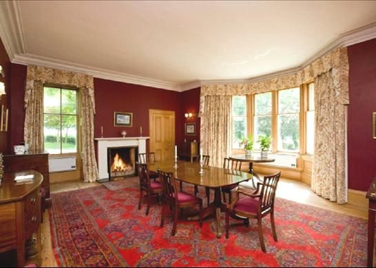
INTERIOR: not seen 1998.
ANCILLARY STRUCTURE 1: single storey, 10-bay rectangular plan outbuilding to W (former dairy in part). Sandstone rubble; tooled sandstone dressings. NE (ENTRANCE) ELEVATION: boarded timber door off-set to left of centre; single windows in flanking bays; single window in penultimate bay to outer left; large window in bay to outer left. Boarded timber door off-set to right of centre; single windows in flanking bays; boarded timber door in penultimate bay to outer right; boarded timber garage doors in bay to outer right. Various small pane timber windows; small skylight. Grey slate roof; raised skews; replacement rainwater goods. INTERIOR: not seen 1998.
ANCILLARY STRUCTURE 2: single storey, 2-bay, rectangular plan long outbuilding to NW (stable). Sandstone rubble; tooled sandstone dressings. SE (ENTRANCE) ELEVATION: boarded timber door at ground off-set to right of centre; small opening aligned beneath apex. NE (SIDE) ELEVATION: widely-spaced bays, single window in bay to outer left; small single window in bay to outer right. 6- and 8- pane glazing in timber windows. Grey slate roof; raised stone skews; replacement rainwater goods. INTERIOR: not seen 1998.
GARDEN WALLS AND BOUNDARY WALLS: rubble-coped, rubble walls enclosing near rectangular-plan walled garden to N with round arched pedestrian entry set in N side. Rubble-coped, rubble boundary walls enclosing site (splayed flanking entrance); timber gates.
No longer a working farm, Fogorig has been subdivided, leaving the main house separate from the farm buildings set to its W. Nevertheless, the house remains much as it was when first complete, with good detailing throughout. Although Fogorig farm is shown on earlier maps, such as Blackadder's 1797 map, the house itself derives from a later date, not appearing on an Ordnance Survey map until 1900. Rutherfurd refers to a Mr Thomas Allan as farmer here in 1866.
External links are from the relevant listing authority and, where applicable, Wikidata. Wikidata IDs may be related buildings as well as this specific building. If you want to add or update a link, you will need to do so by editing the Wikidata entry.


Other nearby listed buildings