Latitude: 53.1666 / 53°9'59"N
Longitude: -3.6614 / 3°39'41"W
OS Eastings: 289029
OS Northings: 364566
OS Grid: SH890645
Mapcode National: GBR 69.4K2X
Mapcode Global: WH65S.QNNR
Plus Code: 9C5R588Q+JC
Entry Name: Pont-y-Garreg Newydd
Listing Date: 23 June 1967
Grade: II
Source: Cadw
Source ID: 90
Building Class: Transport
ID on this website: 300000090
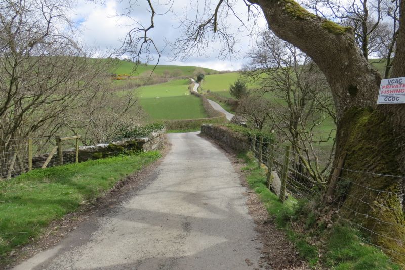
Location: The bridge carries the minor road between Pandy Tudur and Llansannan over the Afon Cledwen, approximately 3.5km E of Pandy Tudur.
County: Conwy
Town: Abergele
Community: Llangernyw
Community: Llangernyw
Traditional County: Denbighshire
Tagged with: Architectural structure
Probably built c1770.
Road bridge, gently cambered, built of local shale rubble with single wide semi-elliptical arch of thin rubble slabs springing from ground level with a projecting regulating course. Spandrels rise uninterrupted to parapets with oversailing copings. The parapets curve outward at each end.
Included as an example of a largely unaltered country bridge of a type erected in connection with improvements in rural communications in the late C18 and early C19.
External links are from the relevant listing authority and, where applicable, Wikidata. Wikidata IDs may be related buildings as well as this specific building. If you want to add or update a link, you will need to do so by editing the Wikidata entry.


Other nearby listed buildings