History in Structure

Old School House and Holmleigh

A Grade II Listed Building in Usk, Monmouthshire

More Photos »
Approximate Location Map
Large Map »

Coordinates

Latitude: 51.7023 / 51°42'8"N

Longitude: -2.9026 / 2°54'9"W

OS Eastings: 337723

OS Northings: 200784

OS Grid: SO377007

Mapcode National: GBR J9.3YDN

Mapcode Global: VH79V.MGWV

Plus Code: 9C3VP32W+WX

Entry Name: Old School House and Holmleigh

Listing Date: 1 April 1974

Last Amended: 30 April 2004

Grade: II

Source: Cadw

Source ID: 2153

Building Class: Domestic

ID on this website: 300002153

Location: Near N corner of Church Street.

County: Monmouthshire

Community: Usk (Brynbuga)

Community: Usk

Built-Up Area: Usk

Traditional County: Monmouthshire

Tagged with: School building

Find accommodation in
Usk

History

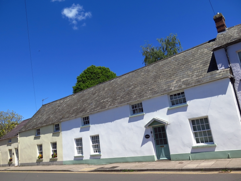
Early C19 school converted to 2 houses in late C20.

Exterior

Two houses converted from old school. Two storeys, stucco, slate roofs. Number 23, Old School House, to L has two broad 8-pane hornless sashes set at eaves. On ground floor, two 16-pane hornless sash windows; to L, modern (?) single storey block with half-glazed modern door and 16-pane sash window to its L. Number 25, Holmleigh has three broad 8-pane sashes at eaves. On ground floor, two 16-pane sash windows, modern half-glazed door under gabled hood, and further 16-pane sash window.

Reasons for Listing

Listed for historic interest and for group value with other buildings in Maryport Street.

External Links

External links are from the relevant listing authority and, where applicable, Wikidata. Wikidata IDs may be related buildings as well as this specific building. If you want to add or update a link, you will need to do so by editing the Wikidata entry.

Recommended Books

Other nearby listed buildings

  • II The Old Grammar School and attached iron railings
    Towards the top of Maryport Street and facing down Church Street towards the Priory.
  • II 20 Maryport Street
    At the top end of the upper W range of Maryport Street, adjacent to the Old Grammar School and the first of the domestic range opening onto the flagged and cobbled pavement.
  • II 22 Maryport Street
    At the top end of the upper W range of Maryport Street, adjacent to the Old Grammar School and the first of the domestic range opening onto the flagged and cobbled pavement.
  • II 24 Maryport Street
    Part of a group set back from road with cobbled forecourts and stone-flagged paths.
  • II Wood Cutter's Cottage
    Part of a group set back from road with cobbled forecourts and stone-flagged paths.
  • II Ashley House
    Towards the middle of the upper W range of Maryport Street, a prominent building on a larger scale than the flanking earlier cottages.
  • II NO.14 Priory Street, Gwent
    The S one of a pair of listed houses on the W side of the street facing the walled garden to Ty Brith.
  • II NO.30 Maryport Street, Gwent
    Part of a group set back from the road towards the lower end of the upper W range of the street.

BritishListedBuildings.co.uk is an independent online resource and is not associated with any government department. All government data published here is used under licence. Please do not contact BritishListedBuildings.co.uk for any queries related to any individual listed building, planning permission related to listed buildings or the listing process itself.

British Listed Buildings is a Good Stuff website.