Approximate Location Map
Large Map »
Latitude: 51.7035 / 51°42'12"N
Longitude: -2.902 / 2°54'7"W
OS Eastings: 337766
OS Northings: 200915
OS Grid: SO377009
Mapcode National: GBR J9.3YKD
Mapcode Global: VH79V.NF6Y
Plus Code: 9C3VP33X+C6
Entry Name: The Jubilee Clock
Listing Date: 1 April 1974
Last Amended: 30 April 2004
Grade: II
Source: Cadw
Source ID: 2206
Building Class: Gardens, Parks and Urban Spaces
ID on this website: 300002206
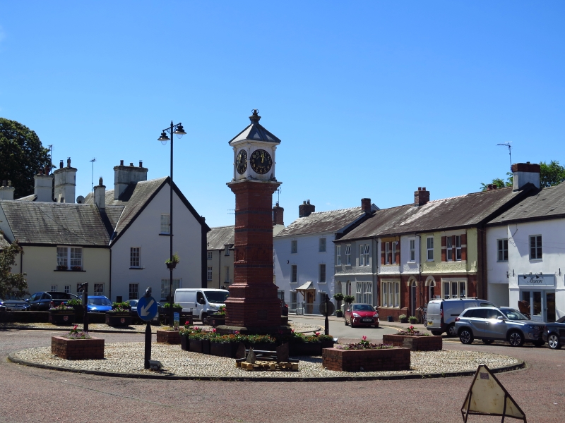
Location: In the centre of Twyn Square, within a cobbled surround which also acts as a roundabout.
County: Monmouthshire
Town: Usk
Community: Usk (Brynbuga)
Community: Usk
Built-Up Area: Usk
Traditional County: Monmouthshire
Tagged with: Architectural structure
Erected in 1887 by public subscription in honour of Queen Victoria's Jubilee 1887. Moved to present position in 1970s from original site near chapel.
Victorian clock tower. A free standing square column in red brick with glazed and unglazed terracotta details supporting a four-sided clock. The column stands on a two-tiered plinth of stone and blue brick, is itself tiered at base and has 4 black bands with nailhead moulding above and a decorative cornice. Relief terracotta plaque of bust of Queen Victoria at W, metal access hatch to clock at S, terracotta date inscription plaque at E and metal inscription plaque at N with terracotta plaque depicting Royal Arms above. There are 4 small ringed columns at the corners surrounding the clock faces which are painted black with gold figures in Roman numerals, set within a white painted boarded surround. Pyramidal lead cap at top surmounted by a small crown.
An important local monument in a prominent position. Group value with other listed buildings in Twyn Square and Priory Street.
External links are from the relevant listing authority and, where applicable, Wikidata. Wikidata IDs may be related buildings as well as this specific building. If you want to add or update a link, you will need to do so by editing the Wikidata entry.


Other nearby listed buildings
