Approximate Location Map
Large Map »
Latitude: 53.2795 / 53°16'46"N
Longitude: -3.8264 / 3°49'35"W
OS Eastings: 278321
OS Northings: 377389
OS Grid: SH783773
Mapcode National: GBR 1ZQJ.D3
Mapcode Global: WH654.6T5R
Plus Code: 9C5R75HF+QC
Entry Name: Pont Pensarn
Listing Date: 8 October 1981
Last Amended: 5 May 2006
Grade: II
Source: Cadw
Source ID: 3313
Building Class: Transport
ID on this website: 300003313
Location: Immediately S of the railway and SW of the castle.
County: Conwy
Town: Conwy
Community: Conwy
Community: Conwy
Locality: Pont Pensarn
Built-Up Area: Conwy
Traditional County: Caernarfonshire
Tagged with: Road bridge
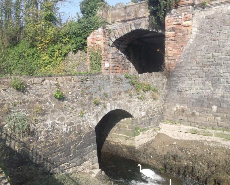
Probably C18 or early C19 and shown on the 1848 Tithe map.
A single-span double-carriageway road bridge of coursed rubble stone and segmental arch of tooled voussoirs. The plain parapet has been partly renewed with cement coping on the E side. A SE square rock-faced terminal pier is part of the forecourt wall of the adjoining bowling green. On the SW side is a rectangular terminal pier with saddleback coping. It is abutted by a later rubble-stone boundary wall of the adjoining premises. On the N side the parapet abuts the railway bridge.
Listed for its special interest as a rare surviving vernacular road bridge close to the town centre.
External links are from the relevant listing authority and, where applicable, Wikidata. Wikidata IDs may be related buildings as well as this specific building. If you want to add or update a link, you will need to do so by editing the Wikidata entry.


Other nearby listed buildings
