Approximate Location Map
Large Map »
Latitude: 53.2306 / 53°13'50"N
Longitude: -4.1133 / 4°6'47"W
OS Eastings: 259036
OS Northings: 372476
OS Grid: SH590724
Mapcode National: GBR 5Q.0H98
Mapcode Global: WH547.S2H6
Plus Code: 9C5Q6VJP+6M
Entry Name: Revetment Walls and Railings
Listing Date: 2 August 1988
Last Amended: 2 August 1988
Grade: II
Source: Cadw
Source ID: 4093
Building Class: Domestic
ID on this website: 300004093
Location: Short sunken section of the former London to Holyhead Turnpike road cut through the hillside. Reached off the Llandegai Road opposite the road to Port Penrhyn and off the High Street beside Tan y Coe
County: Gwynedd
Town: Penybryn
Community: Bangor
Community: Bangor
Locality: Cutting
Built-Up Area: Bangor
Traditional County: Caernarfonshire
Tagged with: Wall
The road was constructed by Thomas Telford following pressure by Irish MP’s. The Shrewsbury to Bangor section was begun in 1815 and reached Bangor in 1817. The road was then realigned in 1934 taking the traffic away from the High Street thereby isolating this section.
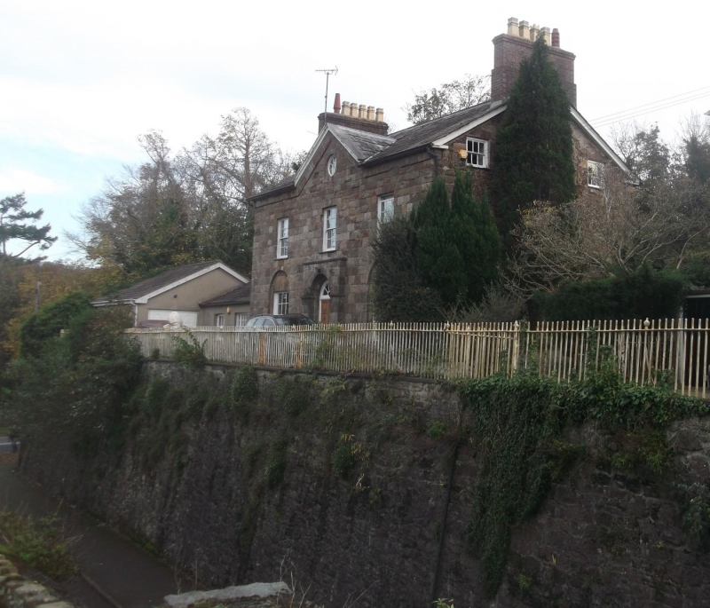
Tarmacadamed road with pavement to S side. Bounded by tall and battered rubble walls; that to S side begins at the E end, full height with an end pilaster. It is topped by late Georgian iron railings with urn finials bordering the drive to The Old Farmhouse and Penybryn House and continuing across the bridge. Ramps down steeply beyond the bridge and continues with vertically laid coping, partly broken and overgrown; steps up immediately before Tan-y-Coed in front of which the revetment wall is coursed rubble and topped by iron railings; terminated at the gated entrance.
The N side begins lower at either end, especially to E. Ramps upwards towards the bridge with vertically laid coping stones; partly rebuilt. At the far W end a low plinth carried iron railings with spearhead finials and curved around to terminating pier.
Group value with Penybryn House, The Old Farmhouse, Penybryn Bridge and the Portico to the former Penrhyn Arms Hotel.
External links are from the relevant listing authority and, where applicable, Wikidata. Wikidata IDs may be related buildings as well as this specific building. If you want to add or update a link, you will need to do so by editing the Wikidata entry.


Other nearby listed buildings
