Approximate Location Map
Large Map »
Latitude: 53.2307 / 53°13'50"N
Longitude: -4.1119 / 4°6'42"W
OS Eastings: 259128
OS Northings: 372488
OS Grid: SH591724
Mapcode National: GBR 5Q.0HM3
Mapcode Global: WH547.T243
Plus Code: 9C5Q6VJQ+76
Entry Name: Penrhyn Bridge, including parapet walls on the approach road to Penrhyn Castle Port
Listing Date: 2 August 1988
Last Amended: 2 August 1988
Grade: II
Source: Cadw
Source ID: 4099
Building Class: Transport
ID on this website: 300004099
Location: Spanning the Afon Cegin at the inner end of Penrhyn Docks. Reached off the Llandegai road and carrying the rear drive into the Penrhyn Estate.
County: Gwynedd
Community: Bangor
Community: Bangor
Locality: Penrhyn
Built-Up Area: Bangor
Traditional County: Caernarfonshire
Tagged with: Bridge
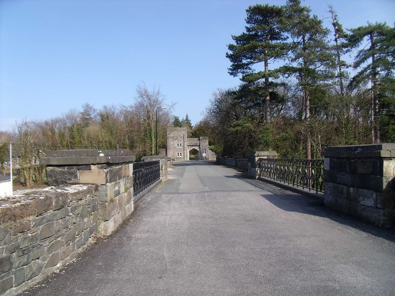
Dated 1820 and initialled GHDP; probably by Benjamin Wyatt, architect to the estate.
Coursed rubble. Single segmental arch with voussoirs, keystone and arch ring; iron plaque over the raised lettering. The parapet appears to have been rebuilt and has ironwork balustrade. Advanced piers at either end with tall concave recess and swept out bases; the roadway is carried to either side by revetment walls slightly swept out.
The parapets continue on the E bank towards the entrance to Penrhyn Castle with regularly spaced low piers; on the N side the parapet sweeps up over a garden door and curved back to end at a large square pier adjoining the Customs House; on the S side the parapet continues as far as the gate into the adjoining field. To W end the wall ramps down on N side and sweeps up to end on S side joining boundary wall rising to Llandegai Road. Old photographs show that the bridge had iron gates at the W end.
At the E end blow the roadway are 2 segmental arched openings with boarded doors; one to N side partly bricked up. These were originally the arches through which the LNWR Port Siding and Penrhyn Quarry Railway passed - the tracks led directly to the harbour.
External links are from the relevant listing authority and, where applicable, Wikidata. Wikidata IDs may be related buildings as well as this specific building. If you want to add or update a link, you will need to do so by editing the Wikidata entry.


Other nearby listed buildings
