History in Structure

Pont Rhyd-y-croesau

A Grade II Listed Building in Llanystumdwy, Gwynedd

More Photos »
Approximate Location Map
Large Map »

Coordinates

Latitude: 52.9255 / 52°55'31"N

Longitude: -4.2913 / 4°17'28"W

OS Eastings: 246071

OS Northings: 338914

OS Grid: SH460389

Mapcode National: GBR 5H.MN1Z

Mapcode Global: WH44D.1QTL

Plus Code: 9C4QWPG5+6F

Entry Name: Pont Rhyd-y-croesau

Listing Date: 19 October 1971

Last Amended: 31 March 1999

Grade: II

Source: Cadw

Source ID: 4362

Building Class: Transport

ID on this website: 300004362

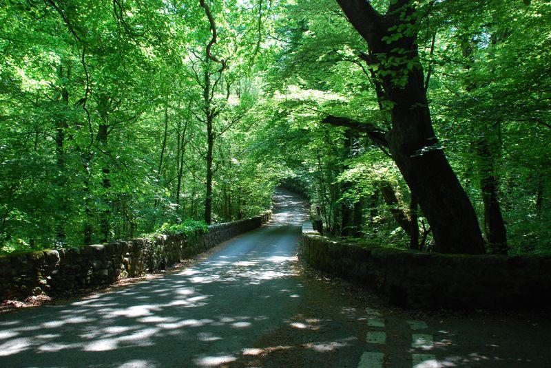
Location: The bridge carries the road running NW from Llanystumdwy across the deep wooded glen of the Afon Dwyfor.

County: Gwynedd

Town: Criccieth

Community: Llanystumdwy

Community: Llanystumdwy

Traditional County: Caernarfonshire

Tagged with: Bridge Road bridge

Find accommodation in
Chwilog

History

The bridge was probably erected in the late C18.

Exterior

Constructed of local stone rubble. A wide single arch spanning c10m and rising to a crown 3.3m above the river. It is constructed with rubble voussoirs and a regulating course, flush spandrels rising to low parapets defining the 3.25m wide road. The NE end terminates in a heavily raking buttress and at the SE end there is a small flood arch. The 43cm thick parapets continue for some 21m on a causeway.

Reasons for Listing

Included as a fine C18 bridge in a beautiful wooded setting.

External Links

External links are from the relevant listing authority and, where applicable, Wikidata. Wikidata IDs may be related buildings as well as this specific building. If you want to add or update a link, you will need to do so by editing the Wikidata entry.

Recommended Books

Other nearby listed buildings

  • II Plas Gwynfryn
    The house stands in its own parkland N of Llanystumdwy, and is reached from a long driveway from the road running N from the W end of the village.
  • II Talhenbont
    The house, until recently known as Plas Hen, stands N of Llanystumdwy and is reached by a driveway leading off the road running NE from Chwilog in the direction of Rhoslan.
  • II Gwynfryn Lodge
    The lodge stands at the S end of the long drive to Plas Gwynfryn, 500m W of Llanystymdwy village.
  • II Bont Fechan
    Located on a cut off section of the main A497 Cricieth to Pwllheli road, SE of the village of Llanystumdwy, and formerly carrying the road over the Afon Dwyfor.
  • II Ysgubor-hen
    The house stands on rising ground mid-way between Llanystumdwy and Chwilog, and 400m N of the toll house on the A497 crossroads.
  • II Old Tollgate Cottage
    The tollgate cottage was erected c1808 to control access to the Portmadoc to Porthdinllaen road, B4354.
  • II Ysgol Llanystumdwy
    The school lies at the W end of the village, on the N side of the road.
  • II No 2, Minafon
    The pair of cottages stands at the W end of the village on the S side of the main road opposite the school.

BritishListedBuildings.co.uk is an independent online resource and is not associated with any government department. All government data published here is used under licence. Please do not contact BritishListedBuildings.co.uk for any queries related to any individual listed building, planning permission related to listed buildings or the listing process itself.

British Listed Buildings is a Good Stuff website.