Approximate Location Map
Large Map »
Latitude: 51.7987 / 51°47'55"N
Longitude: -4.7329 / 4°43'58"W
OS Eastings: 211653
OS Northings: 214653
OS Grid: SN116146
Mapcode National: GBR CW.XYGR
Mapcode Global: VH2P5.X18X
Plus Code: 9C3QQ7X8+FR
Entry Name: Cartshed adjoining Greenway Farm
Listing Date: 17 May 1988
Last Amended: 17 May 1988
Grade: II
Source: Cadw
Source ID: 6518
Building Class: Agriculture and Subsistence
ID on this website: 300006518
Location: Gable end on to the road 300 yds NW from the junction with Kiln Park Road.
County: Pembrokeshire
Community: Narberth (Arberth)
Community: Narberth
Built-Up Area: Narberth
Traditional County: Pembrokeshire
Tagged with: Carriage house
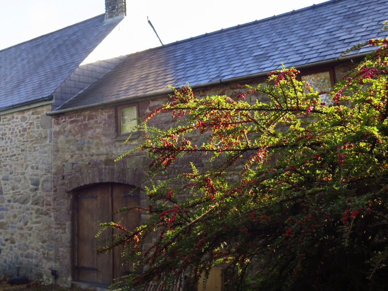
Early C19 linear, lofted range stepped down from adjoining farmhouse. Limewashed squared rubble. Moderately pitched slate roof, plinth eaves.
Cartshed to left with broad stone voussoir arch, vents to doors; wooden shutter to small loft opening under eaves.
Stable to right, through passage type. Later brick voussoir arch and small paned fanlight over plank door. Ventilation slit to right, wooden shutter to small loft opening under eaves.
Upper gable end slate hung with loft window, blocked stable window below, stone lintel.
Loft doorway to centre of rear elevation; stable rear as front.
Good farmyard wall adjoins. Rubble masonry with half-round gatepiers rebated for gate.
Group value.
External links are from the relevant listing authority and, where applicable, Wikidata. Wikidata IDs may be related buildings as well as this specific building. If you want to add or update a link, you will need to do so by editing the Wikidata entry.


Other nearby listed buildings
